License (open-access, http://creativecommons.org/licenses/by-sa/4.0/):
CC-BY-SA
License (open-access):
Prava korištenja: CC-BY-SA
License (open-access):
Journal content is published under CC-BY-SA licence.
Publication date: 2022
Volume: 21
Issue: 37
News
8th International Conference on Cartography and GIS, Nessebar, Bulgaria, June 20-25, 2022
Temenoujka Bandrova

Silvia Marinova
Conference; Cartography; Bulgaria
280840
21.6.2022.
![]()
Visits: 1.707 *
Nessebar is a World cultural heritage city located 30 km north of the city of Burgas. It is one of the major seaside resorts on the southern Bulgarian Black Sea Coast. Due to the city’s abundance of historic buildings, UNESCO included Nessebar in its list of World Heritage Sites in 1983.
This is the place where the 8 th International Conference on Cartography (8ICCGIS) was held from 20 to 25 June 2022. The organizers were the Bulgarian Cartographic Association (BCA), the University of Architecture, Civil Engineering and Geodesy (UACEG) - Sofia and the International Cartographic Association with the support of Bulgarian Science Fund, Military Geographic Service and Municipality of Nessebar. The 8ICCGIS was dedicated to the 80 thAnniversary of the University of Architecture, Civil Engineering and Geodesy and 10 th Anniversary of the Bulgarian Cartographic Association.
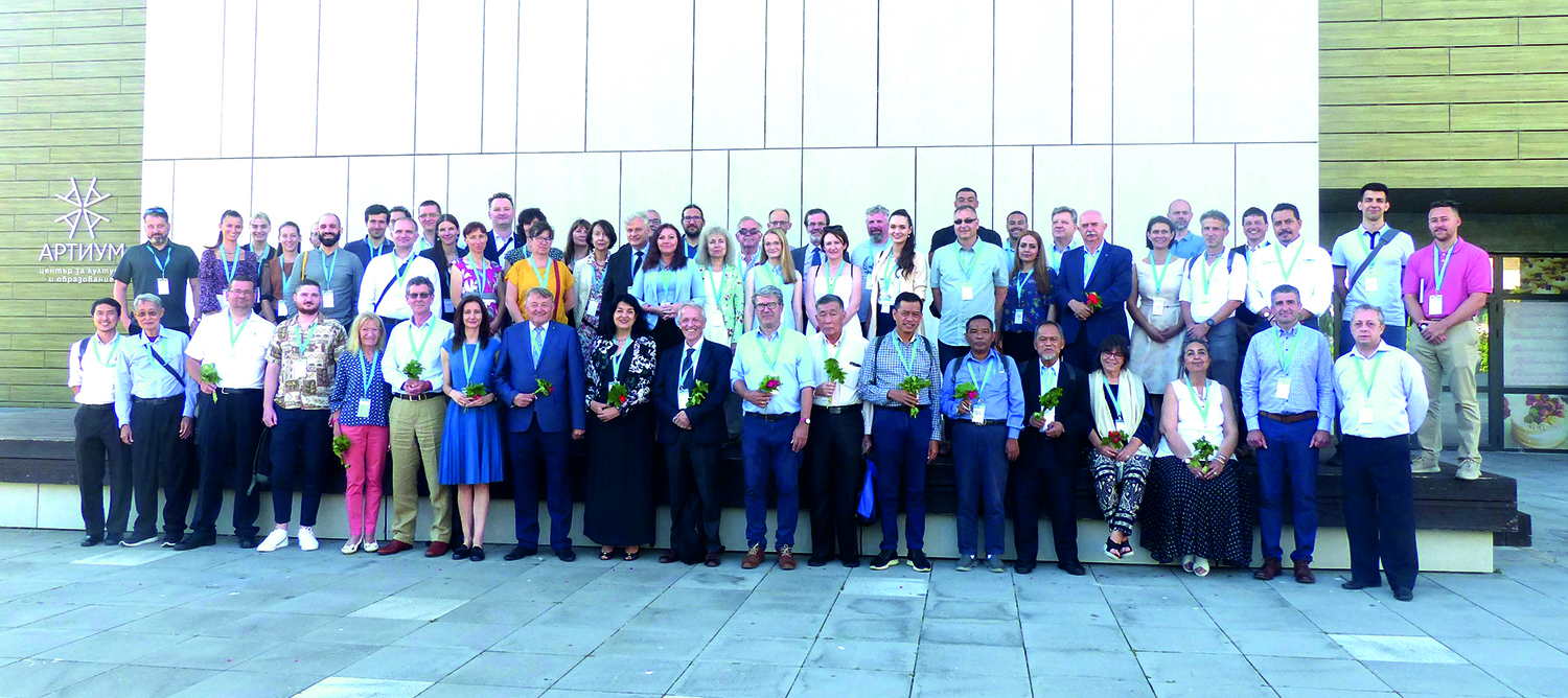
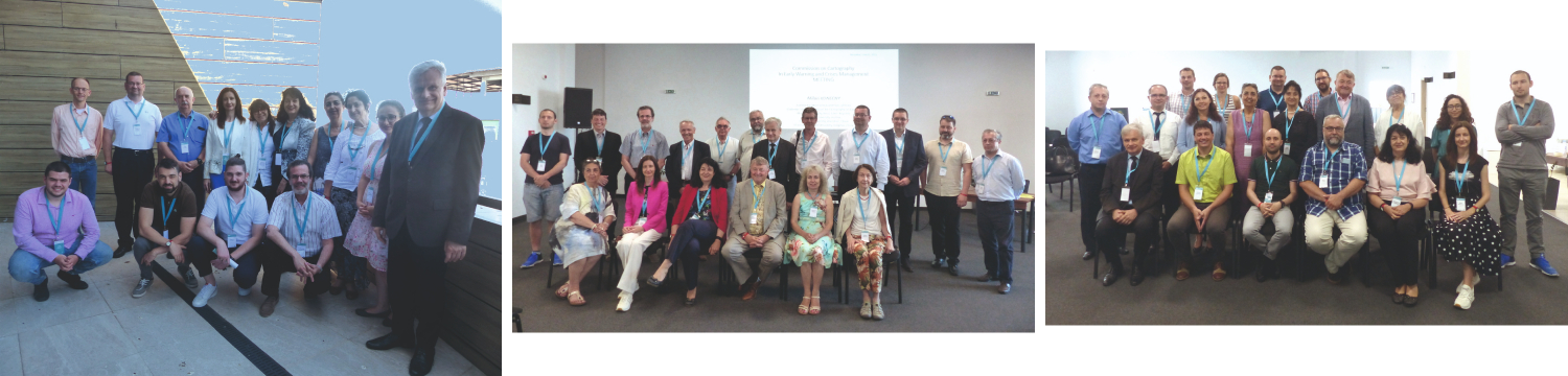
Scientists, geo-specialists, and researchers from 20 countries gathered to report, present, discuss, and teach cartography and GIS. We are certain that delegates were take advantage of all the presentations as well as of the opportunities to collaborate and network together (Fig. 1).
The organizers aim was to share knowledge and experience regarding the latest achievements in Cartography and GIS with a special focus on the Balkan Peninsula, Europe and global affairs. In the Proceedings, you could find various topics such as development of cartography as a science and practice: from special use of historical maps to sustainable development, from BIM to GNSS and Lidar technologies, from geoscientific communications and geodiversity to velocity and dynamic maps. You will find more topics related to the web-based maps and information systems, digital atlases, mapping for natural disasters, earth observation, GIS, Covid-19, 3D cartography, and smart cities.
In the recent years marked by a pandemic, social and natural crises, these topics allow us to fulfil our users’ desire for cartography achievements. They also prove to businessmen, government representatives and scientists the need for real-time cartographic representations and better SDI, GPS and GIS solutions. To deliver them, we need the support and cooperation of domain specialists in different branches of the Earth sciences.
The organizers were proud to announce that the following leader companies in geoinformatics and cartography domains participated as sponsors of the event: ESRI - platinum sponsor, HERE, DataMap-Europe. GeoConnexion, ISPRS International Journal for Geo-Information, Remote Sensing Journal, Coordinates were media partners.
Dr. Silvia Marinova – President of the 8ICCGIS Scientific Committee welcomed all participants to the 8th International Conference on Cartography and GIS in Nessebar. Prof. Temenoujka Bandrova - President of Bulgarian Cartographic Association, ICA Vice-President welcomed the attendees to Bulgaria. On behalf of Mr. Nikolay Dimitrov - Mayor of Nessebar Municipality greetings to all 8ICCGIS participants were addressed by Mr. Victor Borisov – Deputy Mayor of the municipality. Personal greetings were addressed by Prof. Slaveyko Gospodinov - Vice-Rector of University of Architecture, Civil Engineering and Geodesy, Prof. Milan Konečný - President of International Organizing Committee of 8ICCGIS, Czech Republic, Dr. Alessandro Annoni - President of International Society for Digital Earth, Italy and Mr. Nick Land - ESRI Europe, UK.
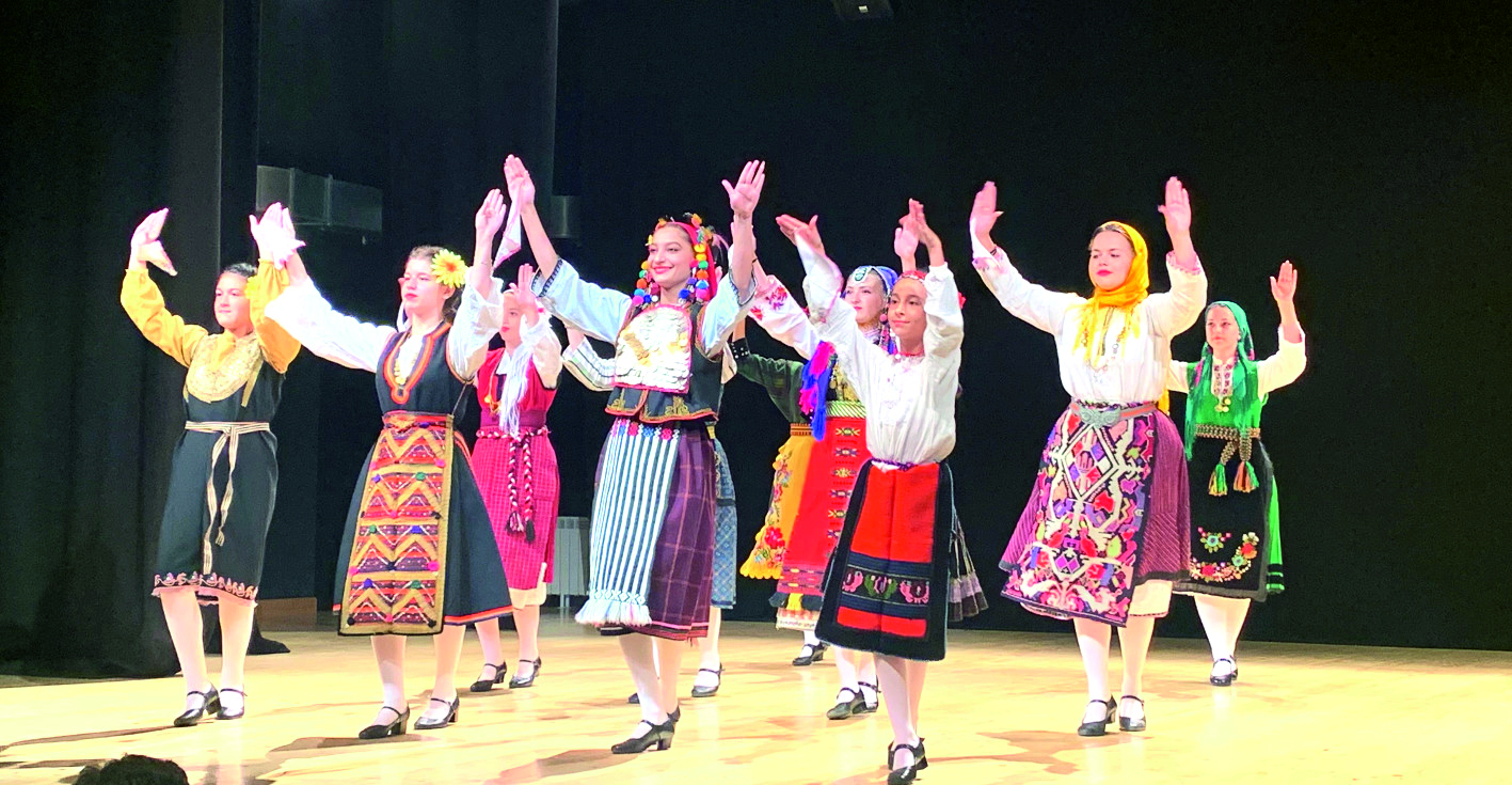
The attendees enjoyed the greetings from Folklore Dance Group "Nezabravka" led by Andiopa Tsvetkova and choreographer Desislava Chervenkova (Fig. 2) and singers and bagpipers from United Municipal School of Arts, Nessebar, teachers: Petko Stoyanov and Neli Taneva.
The Vice-Chair of the ICA commission on Cartography and Children prof. José Jesús Reyes Nunez handed a diploma and a prize to Ivayla Lazarova whose drawing “My Favourite Planet” was awarded (1 st place in the category Ages under 6) at the Barbara Petchenik Children’s World Map Competition during the 30 th International Cartographic Conference in Florence, Italy.
A Seminar on Disaster Risk Reduction – Solutions and Innovations was organized by Prof. Milan Konecny, Vice-Chair of the Commission on Cartography on Early Warning and Crisis Management and former ICA President. The Department of Geography, Masaryk University, Brno, Czech Republic Masaryk was a co-organizer of the Seminar.
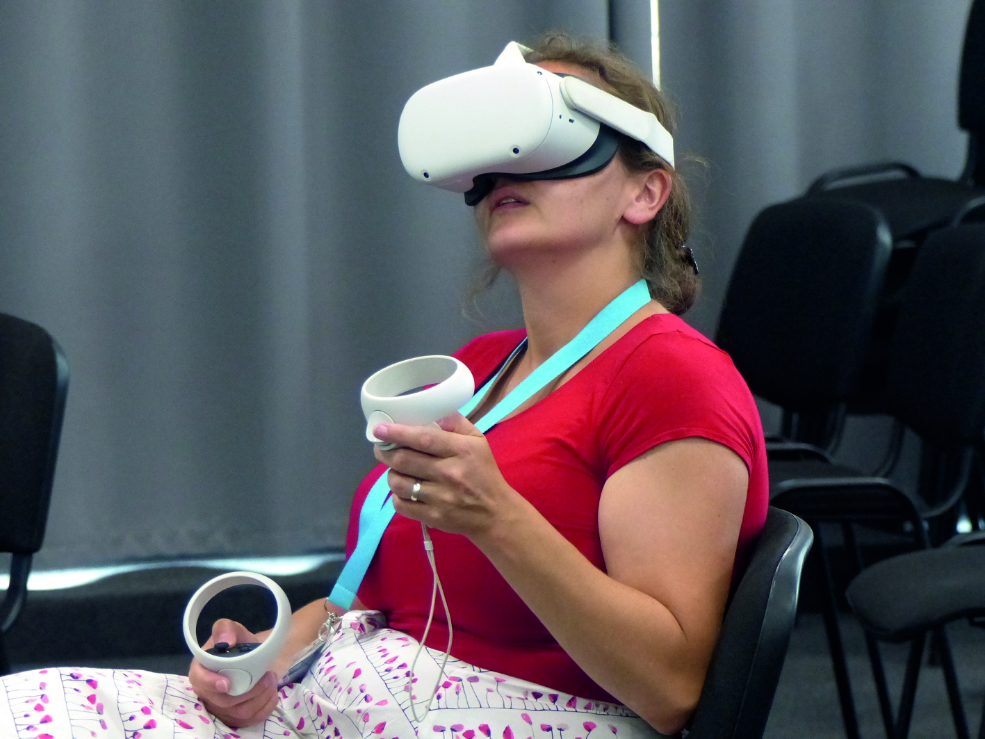
A workshop: Spatial information for Virtual Environments was organized by ICA Commission on User eXperience and aroused interest among many participants (Fig. 3).
A Special ISDE Session Digital Earth for Smart Solutions was organized and supported by International Society for Digital Earth.
As usual, several commissions of the International Cartographic Association held their annual meetings during the conference: Commission on Cartography and Children (Fig. 4a), Commission on Cartography in Early Warning and Crisis Management (Fig. 4b); Commission on Maps and the Internet (Fig. 4c). The commission meetings led to development of guidelines for future work of their members.
The conference keynote speakers inspired a great interest in the participants and set a positive direction for the rest of the conference sessions. Four keynote speeches were given by:
Prof. Milan Konečný, Czech Republic - The UN Challenges for SDGs and Sendai Framework: The Role of Cartographers;
Dr. Alessandro Annoni, ISDE President, Italy - Digital Earth: Yesterday, Today and Tomorrow;
Prof. Georg Gartner, Austria - Maps+ The Evolution of LBS;
Mr Nick Land, ESRI, United Kingdom - Geospatial Infrastructure for an Interdependent World.
More than 70 oral presentations were given in 11 plenary sessions, a seminar session and a special ISDE session and 10 posters were presented in 4 poster sessions. The papers are published in the e-Conference Proceedings: Vol. 1 and Vol. 2, entitled “8th Conference on Cartography and GIS”, Publisher: Bulgarian Cartographic Association, ISSN: 1314-0604 (https://iccgis2020.cartography-gis.com/proceedings/).
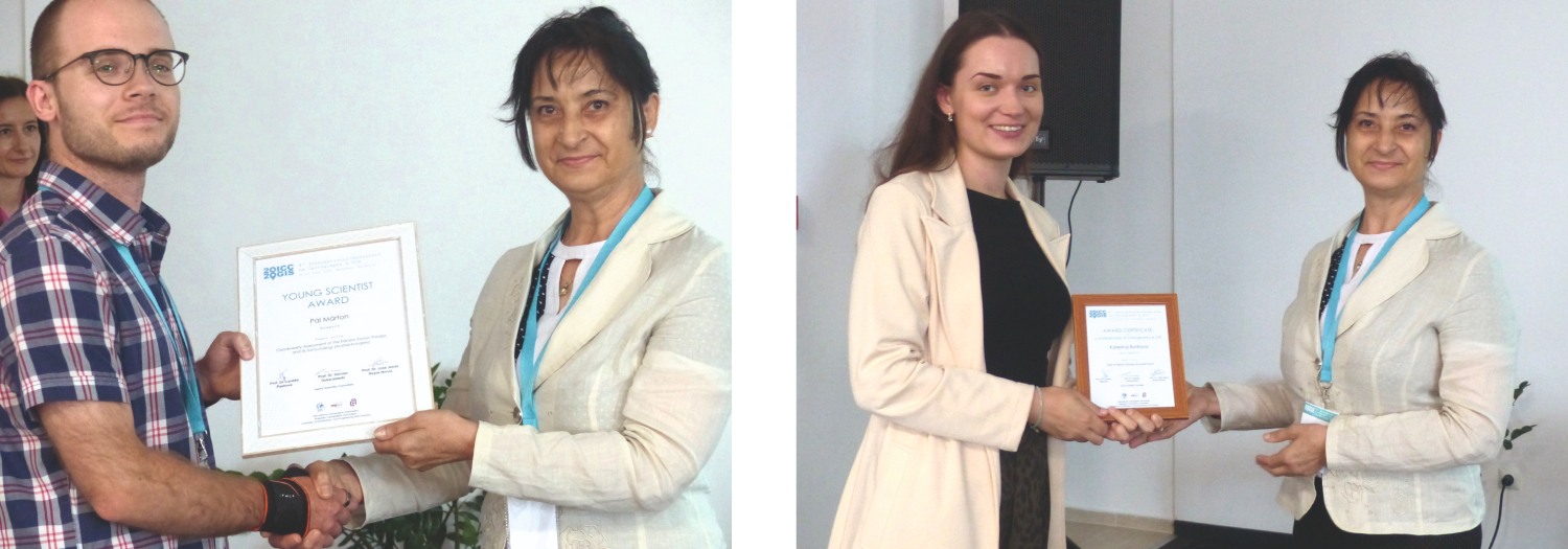
During the 8ICCGIS, the jury members of Award Scientific Committee prof. Lyubka Pashova, prof. Dariusz Dukaczewski and prof. José Jesús Reyes Nunez had the difficult task to evaluate the papers and presentations of young scientists.
The Young Scientist Award was presented to Pál Márton, Hungary for his paper “Geodiversity Assessment of the Eastern Styrian Prealps and its Surroundings (Austria-Hungary)” (Fig. 5a).
The Jury presented also Award Certificate to an Ambassador of Cartography & GIS to Katerina Bortlova, Czech Republic for her paper “GIS in Real Estate Investment” (Fig. 5b).
All participants were invited to a Welcome reception after the opening ceremony and the keynote speeches. This was a great opportunity to meet each other and share initial inspirations for the event.
The Gala dinner gathered the participants again. It was a perfect opportunity for the attendees to get to know the local cuisine and traditions through the rich entertainment program and to celebrate the accomplished work. The attendees got to know national costumes from the different ethnographic regions along with everyday items from the Bulgarian way of life. The programme took the participants on an unforgettable journey through genuine acts including a diverse selection of national dance, a variety show and Nestinarstvo fire-dancing.
The organizers of 8th International Conference on Cartography and GIS express their gratitude to all presenters, chairs, reviewers, authors, sponsors, attendees and distinguished guests!
Nessebar je grad svjetske kulturne baštine koji se nalazi 30 km sjeverno od grada Burgasa. To je jedno od glavnih ljetovališta na južnoj bugarskoj obali Crnog mora. Zbog obilja povijesnih građevina u gradu, UNESCO je 1983. uvrstio Nessebar na svoj popis mjesta svjetske baštine.
To je mjesto gdje je od 20. do 25. lipnja 2022. održana 8. međunarodna konferencija o kartografiji (8ICCGIS). Organizatori su bili Bugarsko kartografsko društvo (BCA), Sveučilište za arhitekturu, građevinarstvo i geodeziju (UACEG) − Sofija i Međunarodno kartografsko društvo uz potporu Bugarskog fonda za znanost, Vojnogeografske službe i Općine Nessebar. 8ICCGIS je bio posvećen 80. godišnjici Sveučilišta za arhitekturu, građevinarstvo i geodeziju i 10. godišnjici Bugarskog kartografskog društva.
Znanstvenici, geostručnjaci i istraživači iz 20 zemalja okupili su se kako bi izvještavali, prezentirali, raspravljali i podučavali kartografiju i GIS. Sigurni smo da su delegati iskoristili sve prezentacije kao i prilike za suradnju i umrežavanje (slika 1).
Cilj organizatora bio je razmijeniti znanje i iskustvo o najnovijim dostignućima u kartografiji i GIS-u s posebnim fokusom na Balkanski poluotok, Europu i globalna pitanja. U Zborniku se mogu naći različite teme poput razvoja kartografije kao znanosti i prakse: od posebne uporabe povijesnih karata do održivog razvoja, od BIM-a do GNSS i Lidar tehnologija, od geoznanstvenih komunikacija i georaznolikosti do brzinskih i dinamičkih karata. Naći ćete više tema vezanih uz karte i informacijske sustave utemeljene na webu, digitalne atlase, kartografiranje prirodnih katastrofa, promatranje Zemlje, GIS, Covid-19, 3D kartografiju i pametne gradove.
Posljednjih godina obilježenih pandemijom, društvenom i prirodnom krizom, te teme omogućuju nam da ispunimo želje naših korisnika za kartografskim dostignućima. One također dokazuju poslovnim ljudima, predstavnicima vlasti i znanstvenicima potrebu za kartografskim prikazima u stvarnom vremenu i boljim rješenjima IPP-a, GPS-a i GIS-a. Da bismo ih isporučili, potrebna nam je podrška i suradnja stručnjaka za područje u različitim granama znanosti o Zemlji.
Organizatori su s ponosom objavili da su kao sponzori događaja sudjelovale sljedeće vodeće tvrtke na području geoinformatike i kartografije: ESRI − platinasti sponzor, HERE, DataMap-Europe. GeoConnexion, ISPRS International Journal for Geo-Information, Remote Sensing Journal i Coordinates bili su medijski partneri.
Dr. Silvia Marinova, predsjednica Znanstvenog odbora pozdravila je sve sudionike 8. međunarodne konferencije o kartografiji i GIS-u u Nessebaru. Prof. Temenoujka Bandrova, predsjednica Bugarskog kartografskog društva, potpredsjednica ICA-e poželjela je dobrodošlicu prisutnima u Bugarsku. U ime Nikolaja Dimitrova, gradonačelnika Nessebara, pozdrave svim sudionicima uputio je Victor Borisov, zamjenik gradonačelnika. Osobne pozdrave uputili su prof. Slavejko Gospodinov, prorektor Sveučilišta za arhitekturu, građevinarstvo i geodeziju, prof. Milan Konečný, predsjednik Međunarodnog organizacijskog odbora 8ICCGIS, Češka, dr. Alessandro Annoni, predsjednik Međunarodnog društva za digitalnu Zemlju, Italija i Nick Land, ESRI Europe, UK. Prisutni su uživali u pozdravima Folklorne plesne skupine "Nezabravka" pod vodstvom Andiope Cvetkove i koreografkinje Desislave Červenkove (sl. 2) te pjevača i gajdaša iz Ujedinjene gradske umjetničke škole u Nessebaru, uz profesore Petka Stojanova i Neli Taneve.
Potpredsjednik Povjerenstva za kartografiju i djecu ICA-e prof. José Jesús Reyes Nunez uručio je diplomu i nagradu Ivajli Lazarovoj čiji je crtež “Moj omiljeni planet” nagrađen (1. mjesto u kategoriji do 6 godina) na natjecanju Barbara Petchenik za dječje karte svijeta tijekom 30. međunarodne kartografske konferencije u Firenci, Italija.
Seminar o smanjenju rizika od katastrofa – rješenja i inovacije organizirao je prof. Milan Konecny, potpredsjednik Povjerenstva za kartografiju za rano upozoravanje i upravljanje krizama ICA-e i bivši predsjednik ICA-e. Odjel za geografiju, Masarykovo sveučilište, Brno, Češka Republika Masaryk je bio suorganizator Seminara.
Radionicu: Prostorne informacije za virtualna okruženja organiziralo Povjerenstvo za korisničko iskustvo ICA-e i izazvalo zanimanje brojnih sudionika (slika 3).
Posebnu sjednicu Digitalna Zemlja za pametna rješenja organiziralo je i podržalo Međunarodno društvo za digitalnu Zemlju (International Society for Digital Earth – ISDE).
Kao i obično, nekoliko povjerenstava Međunarodnoga kartografskog društva održalo je svoje godišnje sastanke tijekom konferencije: Povjerenstvo za kartografiju i djecu (sl. 4a), Povjerenstvo za kartografiju u ranom upozoravanju i upravljanju krizama (sl. 4b); Povjerenstvo za karte i internet (sl. 4c). Sastanci povjerenstava dali su smjernice za budući rad njihovih članova.
Glavni govornici konferencije pobudili su veliko zanimanje sudionika i postavili pozitivan smjer za ostatak konferencije. Četiri glavna govora održali su: Prof. Milan Konečný, Češka Republika - UN-ovi izazovi za SDGs i Sendai okvir: Uloga kartografa Dr. Alessandro Annoni, predsjednik ISDE-a, Italija - Digital Earth: Yesterday, Today and Tomorrow Prof. Georg Gartner, Austrija – Maps + The Evolution of LBS Nick Land, ESRI, Velika Britanija - Geoprostorna infrastruktura za međuovisni svijet.
Više od 70 usmenih izlaganja održano je u 11 plenarnih sjednica, seminarskoj sjednici i posebnoj sesiji ISDE-a, a 10 postera predstavljeno je u 4 posterske sesije. Radovi su objavljeni u e-Zborniku radova: sv. 1 i sv. 2, pod naslovom “8th Conference on Cartography and GIS”, Izdavač: Bugarsko kartografsko društvo, ISSN: 1314-0604 (https://iccgis2020.cartography-gis.com/proceedings/).
Tijekom 8ICCGIS-a, članovi žirija Znanstvenog odbora Nagrade prof. Ljubka Pašova, prof. Dariusz Dukaczewski i prof. José Jesús Reyes Nunez imali su težak zadatak ocijeniti radove i prezentacije mladih znanstvenika. Nagrada mladom znanstveniku dodijeljena je Pálu Mártonu iz Mađarske za njegov rad „Procjena georaznolikosti istočnoštajerskih Prealpa i njegove okolice (Austrija-Mađarska)” (sl. 5a). Žiri je također dodijelio nagradu ambasadorici kartografije i GIS-a Katerini Bortlovoj, Češka Republika za njezin rad "GIS u ulaganju u nekretnine" (sl. 5b).
Svi sudionici bili su pozvani na domjenak dobrodošlice nakon svečanog otvaranja i uvodnih govora. Ovo je bila izvrsna prilika da se međusobno upoznamo i podijelimo početne inspiracije za događaj.
Svečana večera ponovno je okupila sudionike. Bila je to savršena prilika da se kroz bogat zabavni program nazočni upoznaju s domaćom kuhinjom i tradicijom te proslave obavljeni posao. Prisutni su se upoznali s narodnim nošnjama iz različitih etnografskih regija te svakodnevnim predmetima iz bugarskog načina života. Program je sudionike odveo na nezaboravno putovanje kroz prave točke, uključujući raznolik izbor narodnih plesova, estradu i ples na vatri Nestinarstvo.
Organizatori 8. međunarodne konferencije o kartografiji i GIS-u zahvaljuju svim izlagačima, voditeljima, recenzentima, autorima, sponzorima, sudionicima i uvaženim gostima!