License (open-access, http://creativecommons.org/licenses/by-sa/4.0/):
CC-BY-SA
License (open-access):
Prava korištenja: CC-BY-SA
License (open-access):
Journal content is published under CC-BY-SA licence.
Publication date: 2022
Volume: 21
Issue: 37
News
Hrvatsko kartografsko društvo
Miljenko Lapaine
Hrvatsko kartografsko društvo (HKD) osnovano je 10. listopada 2001. U časopisu Kartografija i geoinformacije br. 16 iz 2011. opisana je povijest HKD-a: početci i razvoj okupljanja kartografskih stručnjaka u Hrvatskoj te njegovih prvih 10 godina (Frančula i dr. 2011). U ovom prikazu bit će naglasak na razdoblju 2011−2021.
Hrvatsko kartografsko društvo; obljetnica; izvještaj
280847
21.6.2022.
![]()
Visits: 2.220 *
The Croatian Cartographic Society (CCS) was established on 10 October 2001. The journal Cartography and Geoinformation no. 16 from 2011 describes the history of CCS: the beginnings and development of the gathering of cartographic experts in Croatia and its first 10 years (Frančula et al. 2011). This review will focus on the period 2011−2021.
The main goal of the CCS is to promote and develop cartography and related areas for the common good. The areas of activity of CCS are culture and art, education, science and research and technical culture.
CCS achieves its goals by performing the following activities:
Encouraging creativity and application of scientific achievements in practical and professional work in all forms of cartographic activity
Work on scientific research and professional projects in cartography and related fields
Preparation of scientific and professional studies and expertises
Issuing publications in cartography and related fields in accordance with special regulations
Establishing and taking care of collections of maps, plans, books, photographs and other publications
Connecting with related institutions in Croatia and abroad
Giving opinions and assessments on the cartographic work of organizations and individuals when requested by the authorities or directly interested citizens
Organizing scientific and professional lectures, conferences, seminars, consultations, etc.
Publishing journals, professional and scientific publications, releases, etc.
International cooperation
Membership in international cartographic societies
Conferring awards and recognitions
Training and specialization of members in Croatia and abroad.
The first president of CCS was Miljenko Lapaine. From 2006 to 2009, Stanislav Frangeš served as president and was succeeded by Nada Vučetić. M. Lapaine has been the president of CCS since 2012.
The first secretary of CCS was Dražen Tutić, who was replaced in 2007 by Vesna Poslončec-Petrić. From 2010, D. Tutić once again served as the secretary. From 2012, the secretary was Martina Triplat Horvat. Ivka Kljajić, Miroslava Lapaine and Marina Viličić have been the secretaries since 2016.
In the last ten years, from 2011 to 2021, almost 40 sessions of the Presidency and 13 assemblies were held.
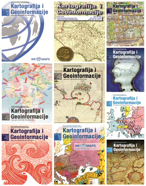
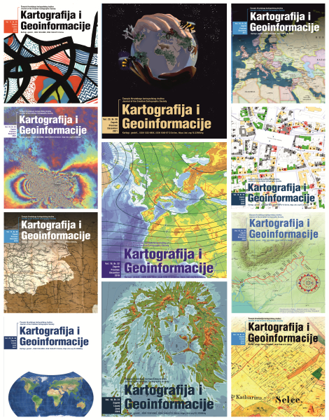
In 2002 CCS started publishing the first Croatian cartographic journal Cartography and Geoinformation (KiG). The first issue was promoted at the 1st Annual General Meeting, held on 18 December 2002. Until 2005, the journal was published annually, and since 2006 it has been published twice a year. So, by October 2011, issues 1–15 and one special issue on the occasion of the 70th birthday of Prof. Emeritus Nedjeljko Frančula were published. From 2011 until the end of 2021, issues 16–36 were published. The journal is bilingual; all articles are in Croatian and English. KiG is cited in several bibliographic databases. The editor-in-chief of issues 1−16 was Miljenko Lapaine. He was followed by Dražen Tutić (17−26), and then Ana Kuveždić Divjak (27−34) and then once again M. Lapaine. The journal is published in analogue and digital form with the financial support of the Ministry of Science and Education, sponsors and donors. In 2017, we received notification from Scopus that our journal had been re-evaluated by the Scopus Content Selection and Advisory Board. It was decided that KiG would remain unchanged in Scopus. The reason for this decision is: This is a Croatian national geography journal with bilingual (!) (English/Croatian) articles of sufficient and consistent quality. Supporting reasons: + The journal maintains a convincing editorial policy. From issue no. 30, each article has a DOI (Digital Object Identifier). The Scribus open-source software was used to prepare the journal for text editing and printing.Frančula (2021a, b) recently wrote in more detail about KiG.
For the past ten years, CCS has been the organizer or co-organizer of the following lectures:
M. Lapaine: 25th International Cartographic Conference and 15th General Assembly of the International Cartographic Association (ICA) in Paris, Faculty of Geodesy in Zagreb, 16 March 2012
M. Lapaine: About the Mercator projection, lecture at the ceremonial academy at the University of Zadar, 23 May 2012
M. Herak: Croatian seismic hazard map − how is it created and how to proceed?, Faculty of Geodesy in Zagreb, 10 October 2012
M. Lapaine: New Cartographic Projection HTRS96/TM, 30 November 2012 at the Annual Assembly of the Association of Surveyors of the Istrian County in Novigrad
M. Pahernik: Military Cartography at the Croatian Military Academy, Faculty of Geodesy in Zagreb, 15 March 2013
D. Mlinarić: Piri Reis and Ottoman Cartography in the Age of Great Geographical Discoveries, lecture at the Technical Museum in Zagreb, 10 October 2013
I. Vlahović: How many dimensions does a geological map show or who needs an unusual compass and why?, Faculty of Geodesy in Zagreb, 14 March 2014
D. Mlinarić: Maps and identities: Cartographic "guest workers" from Croatian areas in the early modern age − Selection from the Novak Collection, Open Days of the National and University Library, 24 February 2015
In 2015, as part of the 13th Science Festival at the Technical Museum in Zagreb, M. Lapaine gave a lecture on the International Map Year
At the 13th Science Festival, R. Župan held a workshop − 3D campus of the University of Zagreb
The European Space Expo was held on the Ban Josip Jelačić Square in Zagreb from 12 to 21 June 2015 M. Lapaine gave a lecture on map projections in planetary cartography
Cartography in Brazil, lecture by M. Lapaine in the Marko Marulić City Library in Split as part of the opening of the HGSS map exhibition, 14 September 2015
M. Lapaine: ICC2015 and Croatian Cartography, 12 October 2015 at the Faculty of Geodesy in Zagreb
T. Korbar: New Basic Geological Map of the Republic of Croatia 1:50 000 − Island of Hvar (Oštrić et al. 2015), 15 December 2015 at the Faculty of Geodesy in Zagreb
At the 8th Symposium of Certified Geodetic Engineers, held in Opatija in 2015 M. Viličić held a lecture on Croatia at the International Cartographic Conference in Rio de Janeiro
M. Lapaine gave an invited lecture Introduction of new coordinate systems in Croatia on the 44th Geodetic Day of Slovenia, in Laško, 4 March 2016
M. Lapaine: Ruđer Bošković, European Surveyor 2016, at the Faculty of Geodesy, 18 March 2016
On 10 October 2016, it was the 15th birthday of CCS. M. Lapaine gave a lecture on the 15 years of CSS activities, Faculty of Geodesy in Zagreb
M. Lapaine: 2017 − year of significant anniversaries for geodesy, astronomy, geophysics and cartography, Faculty of Geodesy, 17 March 2017
D. Tutić and A. Kuveždić Divjak: World Maps and the Winkel Triple Projection, at the Faculty of Geodesy, 19 June 2017
M. Lapaine: Cartographic Projections Without Auxiliary Surfaces, at the Faculty of Geodesy, 19 June 2017.
M. Lapaine participated in the International Cartographic Conference and the Extraordinary General Assembly of the ICA, in Washington D.C., 2–7 July 2017. He gave a lecture on this as part of the celebration of the 16th birthday of CCS, 10 October 2017
M. Gašparović: The Copernicus programme, at the Dr. Antun Barac high school in Crikvenica, 7 September 2017
M. Lapaine: The Behrmann projection or the professor should not be trusted. Faculty of Geodesy, 16 March 2018
R. Župan: Impressions from China, lecture at the Faculty of Geodesy, 14 December 2018
On 16 May 2019, a lecture was held at the Croatian State Archives in Zagreb by D. Mlinarić: Private Cartographic Collection as a Croatian Cultural Treasure: Reflections on the Availability of Historical Heritage
M. Lapaine: Tokyo 2019, lecture at the Faculty of Geodesy, 5 December 2019
In addition to lectures, CCS has been the organizer or co-organizer of the following exhibitions over the past ten years:
10 years of the Croatian Cartographic Society and 10 years of the journal Cartography and Geoinformation, poster at the Science Festival, Technical Museum in Zagreb, 23−28 April 2012
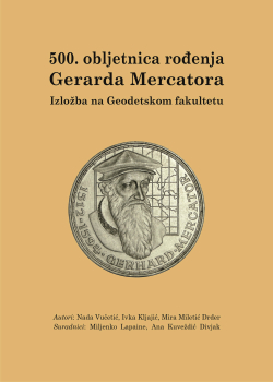
500th anniversary of the birth of Gerard Mercator, 5 March 2012, scientific conference and exhibition in Zagreb, ceremonial academy at the University of Zadar, 23 May 2012
In addition to the symposium Cartography and Art - cARTography, CCS organized in the Gallery on the 1st floor of the Faculty of Geodesy in Zagreb an exhibition of paintings by Vlado Martek entitled kARTe mARTek, in the lobby of the faculty an exhibition of sculptures by Marin Marinić Globalization Atlas, 15 April 2013
Exhibition of nautical charts of the Hydrographic Institute of the Republic of Croatia, University of Zadar, November 2013
Cartographic heritage in the Zadar archives and libraries, exhibition at the State Archives in Zadar, November 2013
Geological maps, exhibition at the Miroslav Krleža Institute of Lexicography, 10 October 2014
Waves, exhibition of children's art works in the Gallery on the 1st floor of the Faculty of Geodesy, from 12 April 2014 to 23 February 2015
Tourist and mountaineering maps of HGSS, exhibition in the Gallery on the 1st floor of the Faculty of Geodesy, 24 February - 5 July 2015 This exhibition was transferred to the Marko Marulić City Library in Split, 14-20 September 2015
We participated with a wall map of the world at a map exhibition held as part of the FIG working week in Sofia, 17–21 May 2015, authors M. Lapaine, Ž. Tutek. We received a Certificate of Appreciation signed by the ICA President Prof. G. Gartner, President of the Bulgarian Cartographic Society Prof. T. Bandrova and the president of FIG Prof. Ch. Potsiou.
The Maps of Istria and Buzet exhibition was set up as part of the 11th Cartography and Geoinformation Conference at the Heritage Museum in Buzet, 8 May − 8 June 2015
Children's drawings, exhibition of children's art works on the subject of cartography in Buzet as part of the 11th Cartography and Geoinformation Conference, Narodni Dom in Buzet, 8 May − 8 June 2015.
The Islands Iž and Rava on Old Maps exhibition, in the Gallery on the 1st floor of the Faculty of Geodesy, the opening was on 7 July 2015, by the author J. Faričić
In the Footsteps of Roman Agrimensores, the exhibition was prepared by students of the Geodetic Technical School from Pula, and the exhibition was opened by M. Lapaine at the Technical Museum in Zagreb on 19 November 2015
The Herzegovina on Maps and Plans exhibition, in the Gallery on the 1st floor of the Faculty of Geodesy, the opening was on 15 December 2015, by the author M. Alilović
The Ruđer Bošković European Surveyor 2016 exhibition was opened on 18 March 2016 in the Gallery on the 1st floor of the Faculty of Geodesy in Zagreb, by the authors M. Lapaine and I. Kljajić
The 200 Years of the Franciscan Cadastre exhibition was opened on 17 March 2017 in the Gallery on the 1st floor of the Faculty of Geodesy in Zagreb, by the authors M. Lapaine and I. Kljajić
Selce on the 1861 cadastral plan and Topographic maps of Selce and its surroundings, exhibition at the Marina Hotel in Selce, 7-9 September 2017
The Forestry Maps Exhibition in the Gallery on the 1st floor of the Faculty of Geodesy, 2018. Authors М. Lapaine and I. Kljajić on the occasion of the 140th anniversary of the founding of the Engineers and Architects Club, the 130th anniversary of the arrival of Vincenc Vinko Hlavinka in Croatia, the 120th anniversary of the Royal Forestry Academy and the 110th anniversary of the establishment of the Geodetic Course in Zagreb
Old cadastral plans of Istria, exhibition at the Faculty of Geodesy on the occasion of the SDI Day and the 14th ICGC, 2018
The exhibition We Love Maps was set up in the Gallery on the 1st floor of the Faculty of Geodesy, University of Zagreb, on 13 April 2019
Exhibition of geological maps in the Gallery on the 1st floor of the Faculty of Geodesy, University of Zagreb, 24 September 2020
In addition, we participated in map exhibitions and exhibitions of children's artworks at all international conferences organized by ICA: Paris 2011, Dresden 2013, Rio de Janeiro 2015, Washington D.C. 2017, Tokyo 2019 and Florence 2021.
Organized or co-organized by CCS, the following conferences have been held over the last ten years:
500th anniversary of Gerard Mercator’s birth, 5 March 2012, scientific conference and exhibition
Spatial Data Infrastructure Days and 8th Cartography and Geoinformation Conference, 25−29 September 2012
On 14 November 2012, CCS marked the World GIS Day with a scientific-professional conference Cartography and Eurocodes held in the faculties of Architecture, Civil Engineering nad Geodesy Hall, in Zagreb. The co-organizers were the Faculty of Geodesy, University of Zagreb, the Croatian Meteorological and Hydrological Service, the Croatian Meteorological Society and the Croatian Standards Institute.
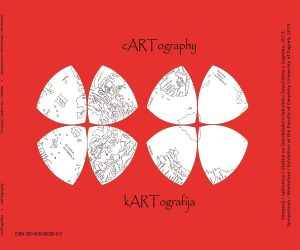
On 15 April 2013, the Croatian Cartographic Society, the Faculty of Geodesy and the Academy of Fine Arts of the University of Zagreb together with the Department of Geography of the University of Zadar organized a symposium entitled Cartography and Art - cARTography. The symposium was held on the birthday of the famous Leonardo da Vinci who was a versatile scientist and artist, but less known for also being a cartographer. We would especially like to emphasize the lecture by prof. Dr. George Gartner, President of ICA.
The 9th Cartography and Geoinformation Conference was held in Zadar from 20 to 22 November 2013, marking the World GIS Day. In addition to CCS, the organizers were the Department of Geography of the University of Zadar and the Croatian Geographical Society.
The 10th Jubilee Conference of Cartography and Geoinformation was organized by CCS in Zagreb from 10 to 12 October 2014
The 11th Conference on Cartography and Geoinformation We Love Maps was held 8−10 May 2015 in Buzet
The 12th Conference on Cartography and Geoinformation along with the International GIS Day, in Zagreb from 10 to 18 November 2016. The co-organizer was the Faculty of Geodesy. The Croatian Choir Kučani from Kuče, conducted by Branko Puceković, performed at the opening ceremony in the hall of the Institute of Lexicography. On the second day of the conference, a Round Table was held at the Faculty of Geodesy, and a visit to the Croatian State Archives with expert guidance.
Ceremonial academy on the occasion of the 80th birthday of Prof. Emer. Nedjeljko Frančula, honorary member of CCS was held at the Faculty of Geodesy on 19 June 2017
The 13th International Conference on Geoheritage, Geoinformation and Cartography, was held in Selce, 7–9 September 2017
The 14th International Conference on Geoinformation and Cartography, organized by CSS in cooperation with the State Geodetic Administration and the Faculty of Geodesy 27–29 September 2018
The 15th International Conference on Geoinformation and Cartography and the Day of the Faculty of Geodesy were successfully organized from 26 to 29 September 2019. The four-day conference was held in Zagreb, Vodnjan, Pula, Brijuni and on the last day in Venice.
CCS and the Faculty of Geodesy, University of Zagreb organized the 16th International Conference on Geoinformation and Cartography (16th ICGC) from 24 to 27 September 2020. The conference was held in Zagreb and Vodnjan with guided tours of Rovinj, Vodnjan and Plitvice Lakes.
The CCS together with the Faculty of Geodesy organized the 17th International Conference on Geoinformation and Cartography (17th ICGC) 23−25 September 2021 in Zagreb and online.
In addition to all of conferences, appropriate publications with the programme and abstracts of lectures were printed and published on the CCS website (www.kartografija.hr).
Organized by CCS, the following guided tours have been held over the last ten years:
On 9 June 2012, a guided tour of Zagreb – Varaždin – Borl – Jerusalem – Zagreb on the occasion of the 250th anniversary of the Vienna Meridian survey and a visit to the oldest trigonometric point in Croatia. This guided tour was to be the initial step in the effort to mark the end point of the measurement of the Vienna Meridian (the tower of the Varaždin Cathedral) with a monument or at least a memorial plaque.
28 September 2012 visit to the Collection of Maps and Atlases of the National and University Library in Zagreb
29 September 2012 guided tour of Hrvatsko Zagorje
22 November 2013 guided tour of the island of Pag, visit to Lun
12 October 2014 guided tour of Medvednica
10 May 2015 full-day guided tour of Istria: Roč, Hum, Pazin, Vrh, Paladini, Butoniga, Motovun, Buzet
18 November 2016, guided tour of the Samobor hills organized by the Student Mountaineering Section of the Faculty of Geodesy
9 September 2017 guided tour of the island of Krk: the Biserujka cave, Punat, Košljun, Vrbnik
29 September 2018, guided tour of Kloštar Ivanić and Čazma. At the old Franciscan monastery next to the church of St. John the Baptist in Kloštar Ivanić, a restored memorial plaque was unveiled marking the origin of the Kloštar-Ivanić coordinate system, in which cadastral plans were made in the middle of the 19th century. After that, a tour of Čazma, Matešin in Bojana, Salaj in Grabovnica, Christmas Story, Kezele in Šumečani was well accepted.
28−29 September 2019 guided tour: Vodnjan, Pula, Brijuni and Venice
25 September 2020 guided tour of Istria, Rovinj (Franciscan Monastery and Centre for Historical Research) and the Lim Channel
26 September 2020 guided tour of Vodnjan
27 September 2020 guided tour of the Plitvice Lakes
25 September 2021 guided tour of Medvednica (Zrinski mines, St. Jacob's Chapel, Queen’s Well, Miroslavec educational trail)
CCS was founded on 10 October 2001. Its 20th birthday was marked on 9 October 2021 by a guided tour of the Baraćeve Caves, Rastoke near Slunj and a visit to Aquatica, the Karlovac freshwater aquarium located on the right bank of the Korana River.
CCS represents Croatia in the International Cartographic Association (ICA). Croatia actively participates in general assemblies with national reports, at conferences with papers and posters, at international cartographic exhibitions and international exhibitions of children's artwork. CCS has prepared Croatia's participation for these conferences:
25th International Cartographic Conference and 15th General Assembly in Paris 2011. We participated with presentations, at the map exhibition and the exhibition of children’s artwork. At that general assembly M. Lapaine was elected Chair of the Commission on Map Projections, which is the first time that a person from Croatia has performed such a duty.
The 26th International Cartographic Conference was held in 2013 in Dresden. We participated with presentations, posters, at the map exhibition and the exhibition of children’s artwork.
The 27th International Cartographic Conference and the 16th ICA General Assembly were held in Rio de Janeiro in 2015. We participated with presentations, at the map exhibition and the exhibition of children’s artwork The national report Cartography in Croatia 2011−2015 was prepared and published in Cartography and Geoinformation no. 22. M. Lapaine received a letter of thanks for chairing the Commission for Map Projections for 2011−2015 and was re-elected to that position for 2015−2019.
The 28th International Cartographic Conference and the 17th Extraordinary General Assembly of the ICA were held in Washington D.C. in 2017. We participated with presentations, at the map exhibition and the exhibition of children’s artwork.
The 29th International Cartographic Conference and the 18th ICA General Assembly were held in Tokyo in 2019. We participated with presentations, at the map exhibition and the exhibition of children’s artwork The national report Cartography in Croatia 2015−2019 was prepared and published in Cartography and Geoinformation no. 32. Evangelos Livieratos from Greece and Miljenko Lapaine from Croatia became Honorary Fellows of ICA, while Takashi Morita from Japan was awarded the Diploma for outstanding services to ICA.
The 30th International Cartographic Conference was held in 2021 in Florence. We participated with presentations, at the map exhibition and the exhibition of children’s artwork Special congratulations go to Magda Oswald and her mentor Ines Janevski from the Fran Krsto Frankopan Elementary School in Osijek. Magda won 2nd place in the 9−12 year old category for her Planet of the Future.
Over the last ten years, CCS has received or presented the following certificates of appreciation and awards:
On 26 September 2012, CSS participated at the Day of the Faculty of Geodesy and on that occasion received a certificate of appreciation for successful cooperation with the Faculty of Geodesy, University of Zagreb.
For the contribution to the successful organization of the 3rd Croatian NSDI and INSPIRE Day and the 7th Conference on Cartography and Geoinformation, the CCS, at the proposal of the Presidency at the 2012 Assembly, distributed certificates of appreciation to the following persons: Velimir Anić, MEng. Geod., Pejo Bročić, MEng. Geod., Drago Butorac, M. Eng. Geod., frigate captain Stipe Jelinčić and Prof. Tea Duplančić Leder PhD. Dragutin Bajilo was presented with a certificate of appreciation for donating the maps that enriched the Society's map collection.
At the CCS Assembly in 2013, Asst. Prof. Ivka Kljajić PhD was awarded the CCS Certificate of Appreciation for many years of very successful organization and management of the competition for the best children's drawings that represented Croatia at international exhibitions for the Barbara Petchenik Award.
The Assembly unanimously accepted the proposal that Ana Kuveždić Divjak, MEng. Geod. be awarded the CCS Certificate of Appreciation for many years of effort and great commitment to the development and promotion of the visual identity of the Croatian Cartographic Society, in particular for the technical editing of the journal Cartography and Geoinformation.
For its contribution to the successful organization of the 9th Conference on Cartography and Geoinformation, at the suggestion of the Presidency, CCS awarded a Certificate of Appreciation to the Department of Geography of the University of Zadar, which was presented to Vera Graovac-Matassi PhD, Head of Department. Also, for its contribution to the successful organization of the 9th Conference on Cartography and Geoinformation, CCS, at the suggestion of the Presidency, awarded a Certificate of Appreciation to the Croatian Geographical Society − Zadar, which was presented to Lena Mirošević PhD, president of the Society.
For a very successful long-term cooperation with CCS and donations to children in competitions for the best art works, and on the unanimously accepted proposal of the Presidency, in 2015 Certificates of Appreciation were awarded to Pejo Bročić and Rade Kvesić.
In 2016 Marija Brajković MSc was presented with a CCS Certificate of Appreciation for her great dedication in promoting CCS, in particular for the organization of the 11th Conference on Cartography and Geoinformation in Buzet in 2015.
Mirko Alilović, MEng. Geod. was awarded a charter for his special contribution to cartography, especially for the monograph "Hercegovina na kartama i planovima” (Herzegovina on Maps and Plans) and for a series of map exhibitions in 2015 and 2016, which contributed in the best possible way to the affirmation of cartography in the International Map Year.
Branko Puceković PhD was awarded a CCS Certificate of Appreciation for organizing the performance and conducting the Croatian Singing Society "Kučani" from Kuče at the opening ceremony of the 12th Conference on Cartography and Geoinformation, in Zagreb, 16 November 2016.
The Croatian Singing Society "Kučani" from Kuče was awarded a CCS Certificate of Appreciation for its performance at the opening ceremony of the 12th Conference on Cartography and Geoinformation, in Zagreb, on 16 November 2016.
Mirjana Jurić MSc was awarded the CCS Award for her special contribution to cartography, in particular for a series of exhibitions, workshops and lectures, thus contributing to the affirmation of Croatian cartography in the best possible way.
In 2018, Dubravka Mlinarić, PhD and Mira Miletić Drder PhD were awarded the CCS Charter for their contribution to cartography, and especially for the co-authorship of the book Zbirka Novak Mappae Croaticae u Zbirci zemljovida i atlasa NSK (The Novak Collection Mappae Croaticae in the NSK Map and Atlas Collection).
The State Geodetic Administration was awarded a Certificate of Appreciation for its support to the Croatian Cartographic Society, especially for participating in the international conference on geoheritage, geoinformation and cartography held in Selce, 7−9 September 2017
The Faculty of Geodesy of the University of Zagreb was awarded a Certificate of Appreciation in 2017 for its long-term support to all activities of the CCS.
Milka Kosanović MEng Geod. and Germano Fioranti were awarded the CCS Charter for their contribution to cartography, in particular for the exhibition Old Maps and Plans of Istria held in August and September 2018 in Vodnjan.
The Croatian Chamber of Chartered Geodetic Engineers was awarded a Certificate of Appreciation for its support to the CCS, especially for the journal Cartography and Geoinformation.
The company Geomatika-Smolčak d.o.o. was awarded a Certificate of Appreciation for its long-term support to all activities of the CCS.
In 2019, the State Geodetic Administration was awarded a Certificate of Appreciation for its support to the Croatian Cartographic Society, especially for its support for participating in the international cartographic conference held in 2019 in Tokyo.
The Croatian Hydrographic Institute was awarded recognition for its entire cartographic activity, in particular for participating in the international cartographic conference held in 2019 in Tokyo.
The Croatian Geological Survey was awarded recognition for its entire cartographic activity, in particular for participating in the international cartographic conference held in 2019 in Tokyo.
Prof. Emer. Nedjeljko Frančula was awarded the CCS Award as the first author of the Cartographic Dictionary published in 2020 after many years of working with collaborators.
Marina Viličić PhD was awarded a CCS Certificate of Recognition for her dedicated and very successful work on the technical editing of the journal Cartography and Geoinformation.
Since 2011, CCS has been actively participating in Science Festivals every year.
CCS has held these book promotions:
Promotion of the monograph Topografske karte na području Hrvatske (Topographic maps on the territory of Croatia), editor S. Frangeš, Croatian State Archives, 18 April 2012
Promotion of Mirko Alilović's monograph Hercegovina na kartama i planovima (Herzegovina on maps and plans) Božo Skoko, Miljenko Lapaine, Željko Obradović and the author spoke about the book on 13 March 2015 in the hall of the Miroslav Krleža Institute of Lexicography in Zagreb. Promotions were then held at the Franciscan Monastery of the Herzegovinian Province in Dubrava in Zagreb, followed by Mostar, Velika Gorica, Ljubuški and Pleternica.
Promotion of the Kartografski rječnik (Cartographic Dictionary), Faculty of Geodesy, 24 September 2020
On 15 April 2013, in addition to the symposium Cartography and Art − cARTography, in cooperation with the Academy of Fine Arts of the University of Zagreb, CCS held an art workshop Karte neotkrivenih područja na Zemlji (Maps of Undiscovered Areas on Earth) with elementary school students.
On 18 November 2015, for the International GIS Day , D. Tutić organized the OSM Geo Awareness Week workshop at the Faculty of Geodesy, University of Zagreb.
The OSM GeoWeek workshop organized by the Open Source Geospatial Lab of the Faculty of Geodesy, CCS and the IT section of the Student Union of the Faculty of Geodesy, 17 November 2016
Workshop Selce on OpenStreetMap, Selce, 7 September 2017, lead by D. Tutić and M. Štanfel
A. Kuveždić Divjak and M. Lapaine participated in the creation of a world map for the tea episode of the TV series Inside the Factory, which was broadcast on BBC 2 in December 2017. The episode is very interesting, educational and fun at the same time. The closing credits also show the names of the CCS and the Faculty of Geodesy of the University of Zagreb
In addition to the 14th conference in Zagreb and the 15th conference in Buzet, orienteering competitions were organized.
Workshop: Creating and editing a map of Buzet − Open Street Map, lead by D. Tutić
In 2019, CCS participated in the project Public Access to the Felbar Collection. The website of this collection has been updated and is available at www.felbar.com
CCS has been a member of the World Cartographic Forum (https://wcf.icaci.org/) since 2021.
In 2020, M. Lapaine became a member of the ICA Cartography Body of Knowledge Working Group.
CCS has had a website since its inception (www.kartografija.hr). It is successfully maintained by Marina Viličić PhD.
The company Krigis d.o.o. regularly takes care of the IT infrastructure of the CCS.
Due to the need to move from Kačićeva 26, a new space for the CCS headquarters was sought. Premise no. 15 on the ground floor of Međimurska 17 in Zagreb was selected as the most favourable solution, with an area of 18.54 m2, condominium (E-108). A sales contract was concluded, and CCS has become the owner of the premise. Design and development of the premises are forthcoming.
Congratulations to the Croatian Cartographic Society on its 20th anniversary and we wish it several more such anniversaries!
Hrvatsko kartografsko društvo (HKD) osnovano je 10. listopada 2001. U časopisu Kartografija i geoinformacije br. 16 iz 2011. opisana je povijest HKD-a: početci i razvoj okupljanja kartografskih stručnjaka u Hrvatskoj te njegovih prvih 10 godina (Frančula i dr. 2011). U ovom prikazu bit će naglasak na razdoblju 2011−2021.
Osnovni cilj HKD-a je promicanje i razvoj kartografije i srodnih područja za opće dobro. Područja djelovanja HKD-a su kultura i umjetnost, obrazovanje, znanost i istraživanje i tehnička kultura.
HKD ostvaruje svoje ciljeve obavljanjem sljedećih djelatnosti:
poticanje stvaralaštva i primjena znanstvenih dostignuća u praktičnom i stručnom radu u svim oblicima kartografske djelatnosti
rad na znanstvenoistraživačkim i stručnim projektima iz kartografije i srodnih područja
izrada znanstvenih i stručnih studija, ekspertiza ili elaborata
izdavanje publikacija iz kartografije i srodnih područja u skladu s posebnim propisima
osnivanje i briga o zbirkama karata, planova, knjiga, fotografija i drugih publikacija
povezivanje sa srodnim institucijama u Hrvatskoj i inozemstvu
davanje mišljenja i ocjena o kartografskom radu organizacija i pojedinaca kada to zatraže tijela vlasti ili neposredno zainteresirani građani
organiziranje znanstvenih i stručnih predavanja, skupova, seminara, savjetovanja i sl.
izdavanje časopisa, stručnih i znanstvenih publikacija, saopćenja i sl.
međunarodna suradnja
članstvo u međunarodnim kartografskim društvima
dodjela nagrada i priznanja
usavršavanje i specijalizacijom članova u Hrvatskoj i inozemstvu.
Prvi predsjednik HKD-a bio je Miljenko Lapaine. Od 2006. do 2009. dužnost predsjednika obnašao je Stanislav Frangeš kojega je naslijedila Nada Vučetić. Od 2012. predsjednik HKD-a je M. Lapaine.
Prvi tajnik HKD-a bio je Dražen Tutić, kojega je 2007. zamijenila Vesna Poslončec-Petrić. Od 2010. dužnost tajnika ponovno je obnašao D. Tutić. Od 2012. tajnica je bila Martina Triplat Horvat. Od 2016. tajnice su Ivka Kljajić, Miroslava Lapaine i Marina Viličić.
U posljednjih deset godina, od 2011. do 2021. održano je gotovo 40 sjednica Predsjedništva i 13 skupština.
Godine 2002. HKD je počeo s izdavanjem prvoga hrvatskog kartografskog časopisa Kartografija i geoinformacije (KiG). Prvi broj promoviran je na 1. godišnjoj skupštini, održanoj 18. prosinca 2002. Do 2005. časopis je izlazio godišnje, a od 2006. izlazi dva puta godišnje. Tako da su do listopada 2011. izašli brojevi 1–15 i jedan posebni broj u povodu 70. rođendana prof. emeritusa Nedjeljka Frančule. Od 2011. do kraja 2021. izašli su brojevi 16–36. Časopis je dvojezičan, svi su članci na hrvatskom i engleskom jeziku. KiG se citira u nekoliko bibliografskih baza. Glavni urednik brojeva 1-16 bio je Miljenko Lapaine. Zatim dolazi Dražen Tutić (brojevi 17-26), pa Ana Kuveždić Divjak (27-34) i onda od broja 35 ponovno M. Lapaine. Časopis izlazi u analognom i digitalnom obliku uz financijsku potporu Ministarstva znanosti i obrazovanja, sponzora i donatora. Od Scopusa smo 2017. godine dobili obavijest da je naš časopis ponovno procijenio Scopus Content Selection and Advisory Board. Odlučeno je da KiG ostaje u Scopusu bez promjena. Razlog zbog kojeg je donijeta ta odluka glasi: This is a Croatian national geography journal with bilingual (!) (english/croatian) articles of sufficient and consistent quality. Supporting reasons: + The journal maintains a convincing editorial policy. Od broja 30 svaki članak ima DOI (Digital Object Identifier). Za pripremu časopisa za prijelom teksta i za tisak prešlo se na slobodan (open source) softver Scribus. Detaljnije o KiG-u napisao je nedavnoFrančula (2021a, b).
U proteklih deset godina, HKD je bio organizator ili suorganizator sljedećih predavanja:
M. Lapaine: 25. međunarodna kartografska konferencija i 15. generalna skupština Međunarodnoga kartografskog društva (ICA) u Parizu, Geodetski fakultet u Zagrebu, 16. 3. 2012.
M. Lapaine: O Mercatorovoj projekciji, predavanje na svečanoj akademiji na Sveučilištu u Zadru, 23. 5. 2012.
M. Herak: Hrvatska karta potresne opasnosti – kako nastaje i kako dalje?, Geodetski fakultet u Zagrebu, 10. 10. 2012.
M. Lapaine: Nova kartografska projekcija HTRS96/TM, 30. 11. 2012. na Godišnjoj skupštini Udruge geodeta Istarske županije u Novigradu
M. Pahernik: Vojna kartografija na Hrvatskom vojnom učilištu, Geodetski fakultet u Zagrebu, 15. 3. 2013.
D. Mlinarić: Piri Reis i osmanska kartografija u doba velikih geografskih otkrića, predavanje u Tehničkom muzeju u Zagrebu, 10. 10. 2013.
I. Vlahović: Koliko dimenzija prikazuje geološka karta ili kome i zašto treba neobičan kompas?, Geodetski fakultet u Zagrebu, 14. 3. 2014.
D. Mlinarić: Karte i identiteti: Kartografski "gastarbeiteri" s hrvatskih prostora u ranom novom vijeku – Izbor iz Zbirke Novak, Dani otvorenih vrata Nacionalne i sveučilišne knjižnice, 24. 2. 2015.
M. Lapaine održao je 2015. godine u sklopu 13. festivala znanosti u Tehničkom muzeju u Zagrebu predavanje International Map Year / Međunarodna godina karata
R. Župan održao je na 13. festivalu znanosti radionicu 3D kampus Sveučilišta u Zagrebu
Na trgu bana Josipa Jelačića u Zagrebu održan je od 12. do 21. 6. 2015. The European Space Expo (Europska izložba o svemiru). M. Lapaine održao je predavanje o kartografskim projekcijama u planetarnoj kartografiji.
Kartografija u Brazilu, predavanje M. Lapainea u Gradskoj knjižnici Marka Marulića u Splitu u sklopu otvaranja izložbe karata HGSS-a, 14. 9. 2015.
M. Lapaine: ICC2015 i hrvatska kartografija, 12. 10. 2015. na Geodetskom fakultetu u Zagrebu.
T. Korbar: Nova Osnovna geološka karta RH 1:50 000 – Otok Hvar (Oštrić i sur. 2015), 15. 12. 2015. na Geodetskom fakultetu u Zagrebu.
M. Viličić održala je na 8. simpoziju ovlaštenih inženjera geodezije, održanom u Opatiji 2015. godine predavanje o Hrvatskoj na međunarodnoj kartografskoj konferenciji u Rio de Janeiru
M. Lapaine održao je pozvano predavanje Uvođenje novih koordinatnih sustava u Hrvatskoj na 44. slovenskom geodetskom danu, u Laškom, 4. 3. 2016.
M. Lapaine: Ruđer Bošković, europski geodet 2016., na Geodetskom fakultetu, 18. 3. 2016.
Dana 10. 10. 2016. bio je 15. rođendan HKD-a. M. Lapaine je održao predavanje o 15 godina djelovanja HKD-a, Geodetski fakultet u Zagrebu
M. Lapaine: 2017. – godina značajnih obljetnica za geodeziju, astronomiju, geofiziku i kartografiju, Geodetski fakultet, 17. 3. 2017.
D. Tutić i A. Kuveždić Divjak: Karte svijeta i Winkelova trostruka projekcija, na Geodetskom fakultetu 19. 6. 2017.
M. Lapaine: Kartografske projekcije bez pomoćnih ploha, na Geodetskom fakultetu 19. 6. 2017.
M. Lapaine sudjelovao je na Međunarodnoj kartografskoj konferenciji i izvanrednoj Generalnoj skupštini ICA-e, u Washingtonu D.C., 2–7. 7. 2017. O tome je održao predavanje u sklopu obilježavanja 16. rođendana HKD-a., 10. 10. 2017.
M. Gašparović: Program Copernicus, u Srednjoj školi dr. Antun Barac u Crikvenici, 7. 9. 2017.
M. Lapaine: Behrmannova projekcija ili profesoru ne treba vjerovati, Geodetski fakultet, 16. 3. 2018
R. Župan: Dojmovi iz Kine, predavanje na Geodetskom fakultetu, 14. 12. 2018.
U Hrvatskom državnom arhivu u Zagrebu održano je 16. 5. 2019. predavanje D. Mlinarić Privatne kartografske zbirke kao hrvatsko kulturno blago: razmišljanja o dostupnosti povijesne baštine.
M. Lapaine: Tokio 2019., predavanje na Geodetskom fakultetu, 5. 12. 2019.
Osim predavanja, HKD je u posljednjih deset godina bio organizator ili suorganizator ovih izložbi:
10 godina Hrvatskoga kartografskog društva i 10 godina časopisa Kartografija i geoinformacije, poster na Festivalu znanosti, Tehnički muzej u Zagrebu, 23−28. 4. 2012.
500. godišnjica rođenja Gerarda Mercatora, 5. 3. 2012, znanstveni skup i izložba u Zagrebu, svečana akademija na Sveučilištu u Zadru, 23. 5. 2012.
Uz simpozij Kartografija i umjetnost – kARTografija, HKD je organizirao u Galeriji na 1. katu Geodetskog fakulteta u Zagrebu izložbu slika Vlade Marteka pod naslovom kARTe mARTek, u predvorju fakulteta izložbu skulpture Marina Marinića Globalizacijski Atlas, 15. 4. 2013.
Izložba pomorskih karata Hrvatskoga hidrografskog instituta, Sveučilište u Zadru, studeni 2013.
Kartografska baština u zadarskim arhivima i knjižnicama, izložba u Državnom arhivu u Zadru, studeni 2013.
Geološke karte, izložba u Leksikografskom zavodu Miroslav Krleža, 10. 10. 2014.
Valovi, izložba dječjih likovnih radova u Galeriji na 1. katu Geodetskog fakulteta, od 12. 4. 2014. do 23. 2. 2015.
Turističko-planinarski zemljovidi HGSS-a, izložba u Galeriji na 1. katu Geodetskog fakulteta, 24. 2. – 5. 7. 2015. Ta je izložba prenijeta u Gradsku knjižnicu Marka Marulića u Splitu, 14. – 20. 9. 2015.
Sudjelovali smo sa zidnom kartom svijeta na izložbi karata koja je održana u sklopu radnog tjedna FIG-a u Sofiji, 17–21. 5. 2015., autori M. Lapaine, Ž. Tutek. Dobili smo Certificate of Appreciation koji su potpisali predsjednik ICA-e prof. G. Gartner, predsjednica Bugarskog kartografskog društva prof. T. Bandrova i predsjednica FIG-a prof. Ch. Potsiou.
Karte Istre i Buzeta, izložba je bila postavljena u sklopu 11. savjetovanja Kartografija i geoinformacije u Zavičajnom muzeju u Buzetu, 8. 5. – 8. 6. 2015., autori M. Lapaine i M. Brajković
Dječji crteži, izložba dječjih likovnih radova na kartografsku temu u Buzetu u sklopu 11. savjetovanja Kartografija i geoinformacije, Narodni dom u Buzetu, 8. 5. – 8. 6. 2015., autori M. Lapaine i I. Kljajić
Izložba Otoci Iž i Rava na starim kartama, u Galeriji na 1. katu Geodetskog fakulteta, otvorenje je bilo 7. 7. 2015., autor J. Faričić
Stopama rimskih agrimensora, izložbu su pripremili učenici Geodetske tehničke škole iz Pule, a izložbu je u Tehničkom muzeju u Zagrebu otvorio M. Lapaine 19. 11. 2015.
Izložba Hercegovina na kartama i planovima, u Galeriji na 1. katu Geodetskog fakulteta, otvorenje je bilo 15. 12. 2015., autor M. Alilović
Izložba Ruđer Bošković europski geodet 2016. otvorena je 18. 3. 2016. u Galeriji na 1. katu Geodetskog fakulteta u Zagrebu, autori M. Lapaine i I. Kljajić
Izložba 200 godina Franciskanskog katastra otvorena je 17. 3. 2017. u Galeriji na 1. katu Geodetskog fakulteta u Zagrebu, autori M. Lapaine i I. Kljajić
Selce na katastarskom planu iz 1861. i Topografske karte Selca i okolice, izložba u hotelu Marina u Selcu, 7−9. 9. 2017.
Izložba Šumarske karte u Galeriji na 1. katu Geodetskog fakulteta, 2018. Autori M. Lapaine i I. Kljajić u povodu 140 obljetnice osnutka Kluba inžinirah i arhitektah, 130 obljetnice dolaska Vincenca Vinka Hlavinke u Hrvatsku, 120 obljetnice osnutka Kraljevske šumarske akademije i 110 obljetnice osnutka Geodetskog tečaja.
Stari katastarski planovi Istre, izložba na Geodetskom fakultetu u povodu Dana IPP-a i 14th ICGC, 2018.
U Galeriji na 1. katu Geodetskog fakulteta Sveučilišta u Zagrebu postavljena je izložba Volimo karte, 13. 4. 2019., autori M. Lapaine i I. Kljajić
Izložba geoloških karata u Galeriji na 1. katu Geodetskog fakulteta Sveučilišta u Zagrebu, 24. 9. 2020.
Osim toga, sudjelovali smo na izložbama karata i izložbama dječjih likovnih radova na svim međunarodnim kartografskim konferencijama u organizaciji ICA-e: Pariz 2011, Dresden 2013, Rio de Janeiro 2015, Washington D.C. 2017, Tokio 2019 i Firenca 2021.
U organizaciji ili suorganizaciji HKD-a održani su posljednjih deset godina ovi skupovi:
500. godišnjica rođenja Gerarda Mercatora, 5. 3. 2012, znanstveni skup i izložba
Dani infrastrukture prostornih podataka i 8. savjetovanje o kartografiji i geoinformacijama, 25-29. 9. 2012.
14. 11. 2012. HKD je obilježio Svjetski dan GIS-a znanstveno-stručnim skupom Kartografija i eurokodovi održanim u Vijećnici AGG fakulteta, u Zagrebu. Suorganizatori su bili Geodetski fakultet Sveučilišta u Zagrebu, Državni hidrometeorološki zavod, Hrvatsko meteorološko društvo i Hrvatski zavod za norme.
15. 4. 2013. Hrvatsko kartografsko društvo, Geodetski fakultet i Akademija likovnih umjetnosti Sveučilišta u Zagrebu zajedno s Odjelom za geografiju Sveučilišta u Zadru organizirali su simpozij pod naslovom Kartografija i umjetnost - kARTografija. Simpozij je održan na rođendan slavnoga Leonarda da Vincija koji je bio svestrani znanstvenik i umjetnik, a malo je poznato da je bio i kartograf. Posebno ističemo predavanje prof. dr. Georga Gartnera, predsjednika ICA-e.
U Zadru je od 20. do 22. 11. 2013. održano 9. savjetovanje Kartografija i geoinformacije kojim je obilježen Svjetski dan GIS-a. Uz HKD organizatori su bili Odjel za geografiju Sveučilišta u Zadru i Hrvatsko geografsko društvo.
10. jubilarno savjetovanje o kartografiji i geoinformacijama organizirao je HKD u Zagrebu od 10. do 12. 10. 2014.
11. savjetovanje o kartografiji i geoinformacijama We Love Maps u Buzetu održano je 8–10. 5. 2015.
12. savjetovanje o kartografiji i geoinformacijama uz svjetski dan GIS-a, u Zagrebu od 16. do 18. 11. 2016. Suorganizator je bio Geodetski fakultet. U dvorani Leksikografskog zavoda na svečanom otvaranju nastupio je Hrvatski pjevački zbor Kučani iz Kuča pod ravnanjem Branka Pucekovića. Drugog dana savjetovanja održan je na Geodetskom fakultetu Okrugli stol.
Svečana akademija u povodu 80. rođendana prof. emer. Nedjeljka Frančule, počasnoga člana HKD-a održana je na Geodetskom fakultetu 19. 6. 2017.
13th International Conference on Geoheritage, Geoinformation and Cartography, održana je u Selcu, 7–9. 9. 2017.
14th International Conference on Geoinformation and Cartography, organizirao je HKD u suradnji s Državnom geodetskom upravom i Geodetskim fakultetom 27–29. 9. 2018.
15th International Conference on Geoinformation and Cartography i Dan Geodetskog fakulteta uspješno su organizirani od 26. do 29. 9. 2019. Četverodnevna konferencija održana je u Zagrebu, Vodnjanu, Puli, na Brijunima i posljednjega dana u Veneciji.
HKD i Geodetski fakultet Sveučilišta u Zagrebu organizirali su od 24. do 27. rujna 2020. godine 16. međunarodnu konferenciju o geoinformacijama i kartografiji (16thICGC). Konferencija je održana u Zagrebu i Vodnjanu uz stručne obilaske Rovinja, Vodnjana i Plitvičkih jezera.
HKD je zajedno s Geodetskim fakultetom organizirao 17. međunarodnu konferenciju o geoinformacijama i kartografiji (17thICGC) 23-25. 9. 2021., u Zagrebu i online.
Uz sva savjetovanja i konferencije tiskane su i objavljene na web-stranicama (www.kartografija.hr) odgovarajuće publikacije s programom i sažetcima predavanja.
U organizaciji HKD-a održani su posljednjih deset godina ovi stručni obilasci:
9. 6. 2012. stručni obilazak Zagreb–Varaždin–Borl–Jeruzalem–Zagreb u povodu 250. godišnjice izmjere Bečkog meridijana i posjetu najstarijoj trigonometrijskoj točki u Hrvatskoj. Taj stručni obilazak trebao je biti početni korak u nastojanju da se završna točka izmjere Bečkog meridijana (toranj varaždinske katedrale) obilježi spomenikom ili barem spomen pločom.
28. 9. 2012. posjet Zbirci karata i atlasa Nacionalne i sveučilišne knjižnice u Zagrebu
29. 9. 2012. stručni obilazak Hrvatskog zagorja
22. 11. 2013. stručni pobilazak otoka Paga, posjet Lunu
12. 10. 2014. stručni obilazak Medvednice
10. 5. 2015. cjelodnevni stručni obilazak Istre: Roč, Hum, Pazin, Vrh, Paladini, Postrojenje Butoniga, Motovun, Buzet
17. 11. 2016. posjet Hrvatskom državnom arhivu uz stručno vođenje
18. 11. 2016. stručni obilazak Samoborskoga gorja u organizaciji Studentske planinarske sekcije Geodetskog fakulteta
9. 9. 2017. stručni obilazak otoka Krka: šiplja Biserujka, Punat, Košljun, Vrbnik
29. 9. 2018. stručni obilazak Kloštra Ivanićkog i Čazme. Na starom franjevačkom samostanu pokraj crkve sv. Ivana Krstitelja u Kloštru Ivanićkom otkrivena je obnovljena spomen-ploča kojom je obilježeno ishodište Kloštar-Ivanićkog koordinatnog sustava, u kojem su sredinom 19. stoljeća izrađivani katastarski planovi. Nakon toga razlegadavanje Čazme, Matešin u Bojani, Salaj u Grabovnici, Božićna priča, Kezele u Šumečanima.
28-29. 9. 2019. stručni obilazak: Vodnjan, Pula, Brijuni i Venecija
25. 9. 2020. stručni obilazak Istre, Rovinj (franjevački samostan i Centar za povijesna istraživanja) i Limski kanal
26. 9. 2020. stručni obilazak Vodnjana
27. 9. 2020. stručni obilazak Plitvičkih jezera
25. 9. 2021. stručni obilazak Medvednice (rudnik Zrinski, kapelica sv. Jakoba, Kraljičin Zdenac, poučna staza Miroslavec)
HKD osnovan je 10. 10. 2001. Njegov 20. rođendan obilježen je 9. 10. 2021. stručnim obilaskom Baraćevih špilja, Rastokama pokraj Slunja i posjetom Aquatici, karlovačkom slatkovodnom akvariju smještenom uz desnu obalu rijeke Korane.
HKD predstavlja Hrvatsku u Međunarodnom kartografskom društvu (International Cartographic association – ICA). Hrvatska aktivno sudjeluje na generalnim skupštinama s nacionalnim izvještajima, na konferencijama s referatima i posterima, na međunarodnim kartografskim izložbama i na međunarodnim izložbama dječjih radova. HKD je pripremio sudjelovanje Hrvatske za ove konferencije:
25. međunarodna kartografska konferencija i 15. generalna skupština u Parizu 2011. Sudjelovali smo s izlaganjima, na izložbi karata i na izložbi dječjih likovnih radova. Na toj generalnoj skupštini M. Lapaine izabran je za predsjednika Povjerenstva o kartografskim projekcijama što je prvi slučaj da takvu dužnost obavlja osoba iz Hrvatske.
26. međunarodna kartografska konferencija održana je 2013. u Dresdenu. Sudjelovali smo s izlaganjima, posterima, na izložbi karata i na izložbi dječjih likovnih radova.
27. međunarodna kartografska konferencija i 16. generalna skupština ICA-e održane su u Rio de Janeiru, 2015. godine. Sudjelovali smo s izlaganjima, na izložbi karata i na izložbi dječjih likovnih radova. Pripremljen je nacionalni izvještaj Kartografija u Hrvatskoj 2011-2015 koji je objavljen u Kartografiji i geoinformacijama br. 23 (Tutić i dr. 2015). M. Lapaine dobio je zahvalnicu za predsjedavanjem Povjerenstvom za kartografske projekcije u razdoblju 2011-2015 i ponovno je izabran na tu funkciju za razdoblje 2015-2019.
28. međunarodna kartografska konferencija i 17. izvanredna generalna skupština ICA-e održane su u Washingtonu D.C. 2017. godine. Sudjelovali smo s izlaganjima, na izložbi karata i na izložbi dječjih likovnih radova.
29. međunarodna kartografska konferencija i 18. generalna skupština ICA-e održane su u Tokiju, 2019. godine. Sudjelovali smo s izlaganjima, na izložbi karata i na izložbi dječjih likovnih radova. Pripremljen je nacionalni izvještaj Kartografija u Hrvatskoj 2015-2019 koji je objavljen u Kartografiji i geoinformacijama br. 32 (Lapaine 2019). Počasni članovi (Honorary Fellows) ICA-e postali su Evangelos Livieratos iz Grčke i Miljenko Lapaine iz Hrvatske, a diplomu za posebne zasluge (Diploma for outstanding services to ICA) dobio je Takashi Morita iz Japana.
30. međunarodna kartografska konferencija održana je 2021. u Firenci. Sudjelovali smo s izlaganjima, na izložbi karata i na izložbi dječjih likovnih radova. Posebne čestitke zaslužuju Magda Oswald i njezina mentorica Ines Janevski iz Osnovne škole Fran Krsto Frankopan iz Osijeka. Magda je osvojila 2. mjesto u kategoriji od 9 do 12 godina za svoj Planet budućnosti (The planet of the future).
HKD je u posljednjih deset godina primio ili uručio ove zahvalnice i nagrade: 26. 9. 2012. HKD je nastupio na Danu Geodetskog fakulteta i tom prigodom dobio Zahvalnicu za uspješnu suradnju s Geodetskim fakultetom Sveučilišta u Zagrebu za doprinos uspješnoj organizaciji 3. hrvatskog NIPP i INSPIRE dana i 7. savjetovanja Kartografija i geoinformacije HKD je na prijedlog Predsjedništva na skupštini 2012. godine podijelilo je zahvalnice: Velimiru Aniću, dipl. ing., Peji Bročiću, dipl. ing., Dragi Butorcu, dipl. ing., kapetanu fregate Stipi Jelinčiću i prof. dr. sc. Tei Duplančić Leder. Za poklonjene karte koje su obogatile zbirku karata Društva zahvalnica je uručena Dragutinu Bajilu.
Doc. dr. sc. Ivki Kljajić dodijeljena je na skupštini HKD-a 2013. zahvalnica HKD-a za višegodišnje vrlo uspješno organiziranje i vođenje natječaja za najbolje dječje crteže koji su predstavljali Hrvatsku na međunarodnim izložbama za nagradu Barbare Petchenik.
Skupština je jednoglasno prihvatila prijedlog da se Ani Kuveždić Divjak, dipl. ing. geod. dodijeli Zahvalnica HKD-a za višegodišnji trud i veliku predanost na izradi i promicanju vizualnog identiteta Hrvatskoga kartografskog društva, a posebno za tehničko uređivanje časopisa Kartografija i geoinformacije.
Za doprinos uspješnoj organizaciji 9. savjetovanja Kartografija i geoinformacije HKD je na prijedlog Predsjedništva dodijelilo zahvalnicu Odjelu za geografiju Sveučilišta u Zadru, koja je uručena dr. sc. Veri Graovac-Matassi, pročelnici Odjela. Isto tako, za doprinos uspješnoj organizaciji 9. savjetovanja Kartografija i geoinformacije HKD je na prijedlog Predsjedništva dodijelilo zahvalnicu Hrvatskom geografskom društvu – Zadar, koja je uručena dr. sc. Leni Mirošević, predsjednici Društva.
Za vrlo uspješnu višegodišnju suradnju s HKD-om i donacije djeci na natječajima za najbolje likovne radove HKD, a na jednoglasno prihvaćeni prijedlog Predsjedništva, dodijelilo je 2015. godine zahvalnice Peji Bročiću i Radi Kvesiću.
God. 2016. mr. sc. Mariji Brajković za veliku predanost u promicanju HKD-a, posebno za organizaciju 11. savjetovanja o kartografiji i geoinformacijama u Buzetu 2015. godine uručena je zahvalnica HKD-a.
Mirko Alilović, dipl. ing. geod. nagrađen je poveljom za osobit doprinos kartografiji, a posebno za monografiju „Hercegovina na kartama i planovima“ te za niz izložbi karata u 2015. i 2016. godini čime je na najbolji mogući način pridonio afirmaciji kartografije u Međunarodnoj godini karata.
Dr. sc. Branku Pucekoviću dodijeljena je zahvalnica HKD-a za organizaciju nastupa i dirigiranje Hrvatskim pjevačkim društvom "Kučani" iz Kuča na svečanom otvorenju 12. savjetovanja o kartografiji i geoinformacijama, u Zagrebu, 16. studenoga 2016.
Hrvatskom pjevačkom društvu "Kučani" iz Kuča dodijeljena je zahvalnica HKD-a za nastup na svečanom otvorenju 12. savjetovanja o kartografiji i geoinformacijama, u Zagrebu, 16. studenoga 2016.
Mr. sc. Mirjani Jurić dodijeljena je Nagrada HKD-a za osobit doprinos kartografiji, a posebno za niz izložbi, radionica i predavanja čime je na najbolji mogući način pridonijela afirmaciji hrvatske kartografije.
God. 2018. dr. sc. Dubravka Mlinarić i dr. sc. Mira Miletić Drder nagrađene su poveljom HKD-a za njihov doprinos kartografiji, a posebno za koautorstvo knjige Zbirka Novak Mappae Croaticae u Zbirci zemljovida i atlasa NSK.
Državnoj geodetskoj upravi dodijeljena je zahvalnica za potporu Hrvatskom kartografskom društvu, posebno za sudjelovanje na međunarodnoj konferenciji o geobaštini, geoinformacijama i kartografiji održanoj u Selcu, 7.–9. rujna 2017.
Geodetskom fakultetu Sveučilišta u Zagrebu dodijeljena je zahvalnica za višegodišnju potporu svim aktivnostima Hrvatskoga kartografskog društva.
Milka Kosanović, dipl. ing. geod. i Germano Fioranti nagrađeni su Poveljom HKD-a za njihov doprinos kartografiji, a posebno za izložbu Stare karte i planovi Istre održane u kolovozu i rujnu 2018. u Vodnjanu.
Hrvatskoj komori ovlaštenih inženjera geodezije dodijeljena je zahvalnica za potporu Hrvatskom kartografskom društvu, posebno za časopis Kartografija i geoinformacije.
Tvrtki Geomatika-Smolčak d.o.o. dodijeljena je zahvalnica za višegodišnju potporu aktivnostima Hrvatskoga kartografskog društva.
God. 2019. Državnoj geodetskoj upravi dodijeljena je zahvalnica za podršku Hrvatskom kartografskom društvu, posebno za potporu za sudjelovanje na međunarodnoj kartografskoj konferenciji održanoj 2019. godine u Tokiju.
Hrvatskom hidrografskom institutu dodijeljeno je priznanje za cjelokupnu kartografsku djelatnost, posebno za sudjelovanje na međunarodnoj kartografskoj konferenciji održanoj 2019. godine u Tokiju.
Hrvatskom geološkom institutu dodijeljeno je priznanje za cjelokupnu kartografsku djelatnost, posebno za sudjelovanje na međunarodnoj kartografskoj konferenciji održanoj 2019. godine u Tokiju.
Prof. emer. Nedjeljku Frančuli dodijeljena je Nagrada HKD-a kao prvom autoru Kartografskog rječnika objavljenog 2020. godine nakon višegodišnjeg rada sa suradnicima.
Dr. sc. Marini Viličić dodijeljena je zahvalnica HKD-a za predan i vrlo uspješan rad na tehničkom uređivanju časopisa Kartografija i geoinformacije.
Od 2011. HKD svake godine aktivno sudjeluje na Festivalima znanosti.
HKD je održao ove promocije knjiga:
Promocija monografije Topografske karte na području Hrvatske, urednik S. Frangeš, Hrvatski državni arhiv, 18. 4. 2012.
Promocija monografije Mirka Alilovića: Hercegovina na kartama i planovima. O knjizi su govorili Božo Skoko, Miljenko Lapaine, Željko Obradović i autor, 13. 3. 2015. u dvorani Leksikografskog zavoda Miroslav Krleža u Zagrebu. Slijedile su promocije u Franjevačkom samostanu Hercegovačkog provincijalata u Dubravi u Zagrebu, zatim u Mostaru, u Velikoj Gorici, u Ljubuškom i u Pleternici.
Promocija Kartografskog rječnika, Geodetski fakultet, 24. 9. 2020.
Uz simpozij Kartografija i umjetnost – kARTografija, HKD je u suradnji s Akademijom likovnih umjetnosti Sveučilišta u Zagrebu organizirao likovnu radionicu Karte neotkrivenih područja na Zemlji s učenicima osnovne škole, 15. 4. 2013.
D. Tutić organizirao je radionicu OSM Geo Awareness Week na međunarodni dan GIS-a, 18. 11. 2015. na Geodetskom fakultetu Sveučilišta u Zagrebu.
Radionica OSM GeoWeek u organizaciji Open Source Geospatial Lab Geodetskog fakulteta, HKD-a i IT sekcije Studentskog zbora Geodetskog fakulteta, 17. 11. 2016.
Radionica Selce na OpenStreetMapu, Selce, 7. 9. 2017. voditelji D. Tutić i M. Štanfel
A. Kuveždić Divjak i M. Lapaine sudjelovali su u izradi karte svijeta za epizodu o čaju TV serije Inside the Factory koja je bila emitirana na programu BBC 2 u prosincu 2017. Epizoda je vrlo zanimljiva, poučna i istodobno zabavna. U odjavnoj špici pojavljuju se uz imena također Hrvatsko kartografsko društvo i Geodetski fakultet Sveučilišta u Zagrebu.
Uz 14. savjetovanje u Zagrebu i 15. savjetovanje u Buzetu oranizirana su natjecanja u orijentaciji.
Radionica: Izrada i uređivanje karte Buzeta – Open Street Map, voditelj je bio D. Tutić.
HKD je sudjelovao 2019. godine na projektu Javna dostupnost Zbirci Felbar. Web-stranice te zbirke su obnovljene i dostupne na adresi www.felbar.com.
HKD je od 2021. članica Svjetskog kartografskog foruma (World Cartographic Forum, https://wcf.icaci.org/).
M. Lapaine postao je 2020. godine članom Radne grupe za Korpus znanja o kartografiji (ICA working Group - Cartography Body of Knowledge).
HKD ima internetske stranice od svojeg osnutka (www.kartografija.hr). Uspješno ih održava dr. sc. Marina Viličić.
Tvrtka Krigis d.o.o. uredno vodi brigu o informatičkoj infrastrukturi HKD-a.
Zbog potrebe preseljenja iz Kačićeve 26, tražen je novi prostor sjedišta HKD-a. Kao najpovoljnije rješenje odabran je lokal br. 15 u prizemlju Međimurske 17 u Zagrebu, površine 18,54 m2, etažno vlasništvo (E-108). Sklopljen je kupoprodajni ugovor i HKD je postao vlasnik tog prostora. Predstoji uređenje prostora.
Čestitamo Hrvatskom kartografskom društvu 20. obljetnicu i želimo mu još nekoliko takvih obljetnica!