License (open-access, http://creativecommons.org/licenses/by-sa/4.0/):
CC-BY-SA
License (open-access):
Prava korištenja: CC-BY-SA
License (open-access):
Journal content is published under CC-BY-SA licence.
Publication date: 2022
Volume: 21
Issue: 38
Vijest
Cartographic Collection of the State Archives in Zadar
Josip Faričić
; Sveučilište u Zadru, Odjel za geografiju
The State Archives in Zadar published the book Cartographic Collection of the State Archives in Zadar, 2022, ISBN 978-953-7434-42-7, 495 pages. The author of the book is the Head of the Department for Information and Documentation Affairs with the User Service of the State Archives in Zadar, specialist archivist Tamara Šarić-Šušak, and the introductory study entitled Cartographic Content in the Funds, Collections and Library of the State Archives in Zadar was written by archival consultant Dubravka Kolić. The book was proofread by Josip Galić and the summary was translated into English by Janet Berković. The book was reviewed by Mirjana Jurić and the signatory of this text. Senior archivist Robert Leljak and archival technician Marija Kero prepared the index, while archival technician reprographer Tomislav Vrsaljko and archival technician reprographer Ivana-Marija Čuka created a digital reproduction of the maps. Nevenka Kalebić helped the author systematise and measure the map dimensions, and Josip Gjergja assisted the author in determining the scale of the maps. The graphic assistant was senior archivist Denis Martinović, and the graphic design was done by Studio Grafikart. The quality printing is the merit of the Kerschoffset printing house. The commitment of many archivists who helped their colleagues indicates great intra-institutional potential. This book is the work of the author, but also the result of the systematic efforts of the entire institution. Indeed, the State Archives in Zadar, under the long-standing leadership of Director Ante Gverić, have made much progress in inventorying, systematising and digitising old maps, and digitised cartographic archive material is currently being processed and published on the archive's website. This will greatly improve the visibility and availability of the old maps stored in various funds and collections, as well as in the library of the State Archives in Zadar.
State Archives in Zadar; Cartographic Collection
295023
24.1.2023.
![]()
Posjeta: 2.391 *
Tamara Šarić-Šušak
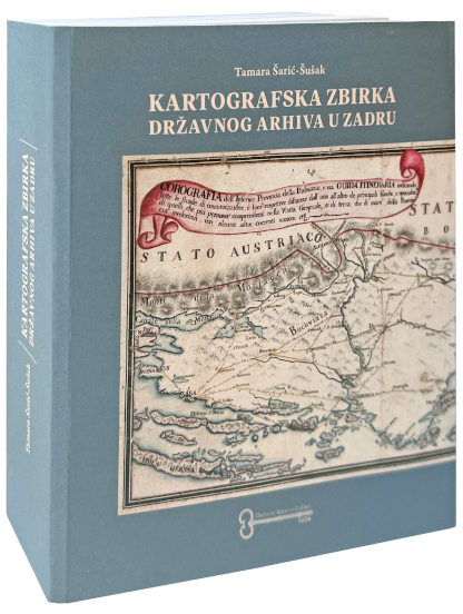
The State Archives in Zadar published the book Cartographic Collection of the State Archives in Zadar, 2022, ISBN 978-953-7434-42-7, 495 pages. The author of the book is the Head of the Department for Information and Documentation Affairs with the User Service of the State Archives in Zadar, specialist archivist Tamara Šarić-Šušak, and the introductory study entitled Cartographic Content in the Funds, Collections and Library of the State Archives in Zadar was written by archival consultant Dubravka Kolić. The book was proofread by Josip Galić and the summary was translated into English by Janet Berković. The book was reviewed by Mirjana Jurić and the signatory of this text. Senior archivist Robert Leljak and archival technician Marija Kero prepared the index, while archival technician reprographer Tomislav Vrsaljko and archival technician reprographer Ivana-Marija Čuka created a digital reproduction of the maps. Nevenka Kalebić helped the author systematise and measure the map dimensions, and Josip Gjergja assisted the author in determining the scale of the maps. The graphic assistant was senior archivist Denis Martinović, and the graphic design was done by Studio Grafikart. The quality printing is the merit of the Kerschoffset printing house. The commitment of many archivists who helped their colleagues indicates great intra-institutional potential. This book is the work of the author, but also the result of the systematic efforts of the entire institution. Indeed, the State Archives in Zadar, under the long-standing leadership of Director Ante Gverić, have made much progress in inventorying, systematising and digitising old maps, and digitised cartographic archive material is currently being processed and published on the archive's website. This will greatly improve the visibility and availability of the old maps stored in various funds and collections, as well as in the library of the State Archives in Zadar.
In the introductory study, Dubravka Kolić gave an overview of the funds, collections and library of the State Archives in Zadar that contain cartographic content, and it deals with different types of maps as individual cartographic creations, as components of various archival files and with atlases. The author of this text rightly emphasised the importance of old maps as a source for historical, geographical, demographic, topographical and other research. She paid special attention to the Cartographic Collection (archive identification code HR-DAZD -383), the beginnings of which cannot be dated with certainty, although the systematic collection and processing of maps only began after the Second World War. The State Archives in Zadar were founded in 1624 on the basis of earlier archival activities and have been in continuous operation for almost four centuries. The chronological range of the archival cartographic material coincides with this fact, as in some collections there are maps that predate the official foundation of the archive. As far as the area shown is concerned, the coverage of the cartographic collection is mostly related to Dalmatia, although there are also many maps of the wider area, namely the whole of present-day Croatia and neighbouring countries (especially those with which Croatia was in a state community in various historical periods), Europe and other continental entities. This spatial extent reflects the fact that Zadar was the administrative centre of Dalmatia during the Venetian administration (1409 – 1797), the first Austrian administration (1797 – 1805), the French administration (1806 – 1813) and the second Austrian administration (1814 – 1918), and thus also the seat of provincial officials and bodies (provveditore generale, governor, Dalmatian parliament, etc.) that needed maps as first-class sources of spatial data. For this reason, but also because of the need to determine provincial legal relations, there were surveying and cartographic workshops in Zadar, so that the city was an important regional centre for map production. The major political changes after the First World War had a negative impact on Zadar's centuries-old function. According to the provisions of the Treaty of Rapallo, Zadar belonged to the Kingdom of Italy and was torn out of its region and the whole of Dalmatia (and Croatia). For this reason, part of the cartographic material was moved to Split, the new administrative centre of the southern Croatian territory, which was organised under various names in the Kingdom of Serbs, Croats and Slovenes, i.e. the Kingdom of Yugoslavia (the name Primorska banovina was retained for the longest time). The Archive of maps for Dalmatia, i.e. the cadastral plans with associated documentation for all Dalmatian cadastral municipalities, which were created during the implementation of the Franciscan cadastral survey, was permanently transferred to Split.
Apart from the Cartographic Collection, maps are the main content of the collections Venetian Cadastre – Grimani Maps (HR-DAZD-6), Venetian Cadastre – Sketches of Cadastral Plans of Zadar, Knin and Imotski (HR-DAZD-8), Venetian Cadastre – Maps of Dalmatia – Collection of the Kurir Family. (HR-DAZD-381), Directorate of Cadastral Surveying (HR-DAZD-382), Graphic Collection (HR-DAZD-552) and funds of the Borelli family (HR-DAZD-348), the Lantana family (HR-DAZD-359) and the Pekota family (HR-DAZD-493) and Miscellanea (HR-DAZD-377). Some maps are kept in other collections and funds, while many valuable atlases are kept in the library of the State Archives (e.g. the Geography of Ptolemy, the Atlas of Mercator, the Corso geografico universale of Coronelli).
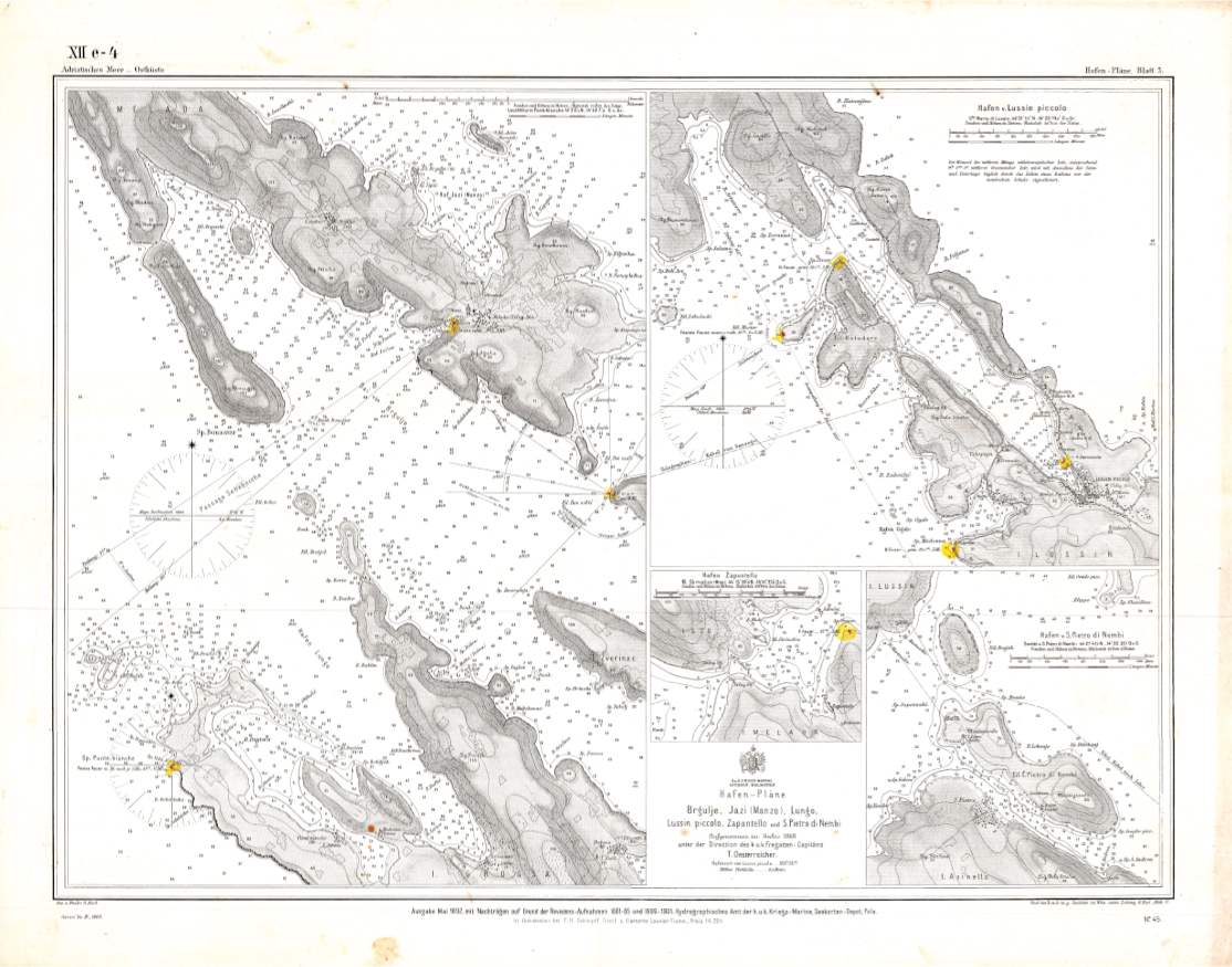
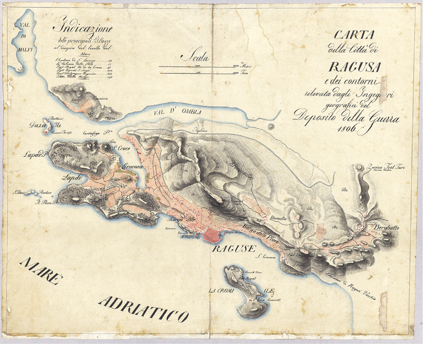
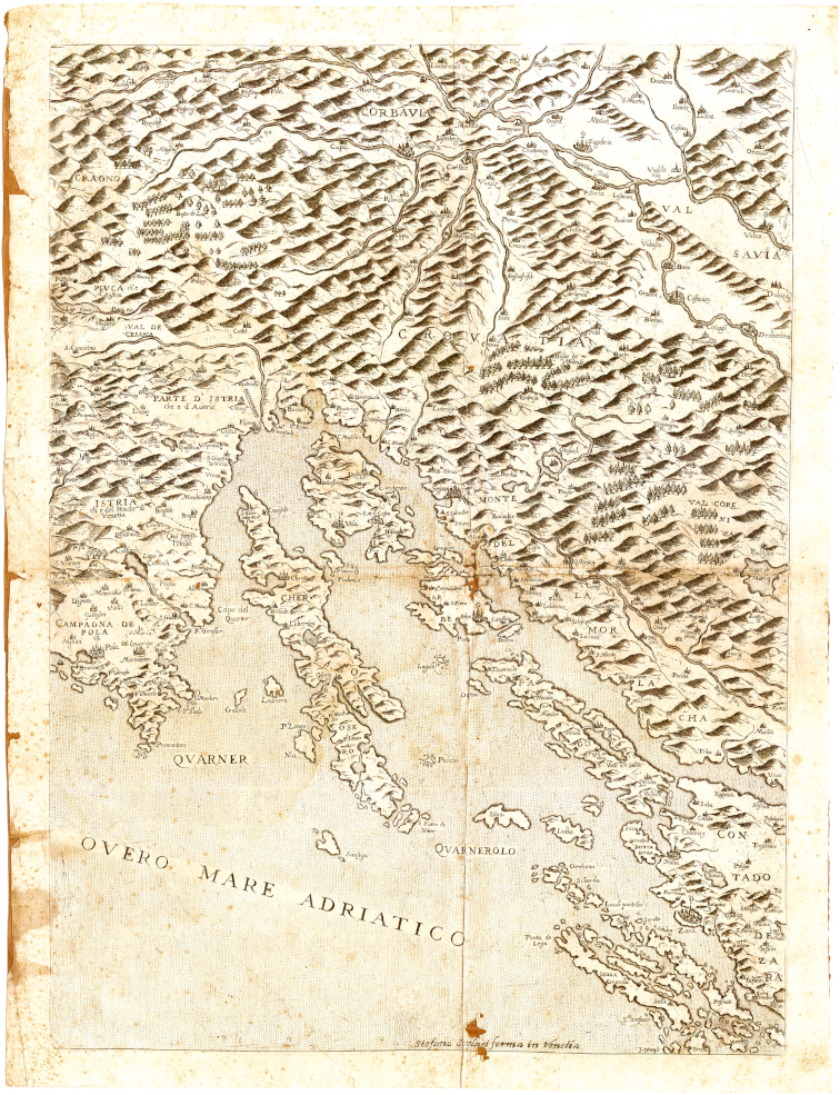
The main part of the book is a systematic, comprehensive and informative work by Tamara Šarić-Šušak. She divides the cartographic representations typologically into 19 units called series: 1. manuscript maps, 2. old printed maps, 3. maritime maps, 4. topographic maps, 5. administrative-administrative maps, 6. cadastral maps, 7. urban maps, 8. demographic maps, 9. transport maps, 10. administrative-political maps, 11. economic maps, 12. hydrographic maps, 13. geological maps, 14. archaeological maps, 15. war maps, 16. historical maps, 17. world maps, 18. atlases and 19. other maps. For each series, the identification code, title, date of creation, level of description, quantity and classification are given and the context (history of the series and method of downloading), content and structure (content of the series, selection, selection and storage periods and classification plan) are described, as well as the conditions of availability and use (condition of availability, condition of publication or reproduction), the language and writing in the material, and the material characteristics and technical conditions (e.g. whether the map was produced on paper or canvas).
All maps in each of these units are described in accordance with the International Standard Bibliographic Description for Cartographic Materials (ISBD – CM), General international standard archival description (ISAD(G)) and International Standard Archival Authority Record for Corporate Bodies, Persons and Families (ISAAR (CPF)). This means that for each map the original title is given (or a subsequent title if the map does not have an original title), author, scale, place and year of creation, i.e. publication of the map and a material description. In the material description, the dimensions of the map, the technique of making the map, and a brief description of the geographical content of the map are given, information about whether a compass rose is drawn on the map or a network of parallels and meridians is printed, about whether and what scale the map is. The descriptions of most maps are accompanied by segments of those maps, and some maps are reproduced in full, on one page, on double pages, or folded maps printed in dimensions larger than the dimensions of the book are inserted. These map reproductions contribute to the function and aesthetics of the entire book.
The book by T. Šarić-Šušak is not the result of research into the development of cartography or a monograph in which the analysis of old maps as a mirror of geographical knowledge and used cartographic techniques was published. The book is a precious handbook for all scientists and other people who, for various reasons, are interested in old maps kept in the State Archives in Zadar. More knowledgeable users of old cartographic works may find some term or expression that is not common in cartography (e.g. vjetrulja for a compass rose, mapa for an old map or cadastral plan, etc.), but it should be taken into account that this is a work that was written for a wide user community and that it is the result of the use of some established archival expressions that have been retained in the titles of individual archival collections and funds (which should be changed in the future). It should be noted that the author of the book has no formal academic education in the field of geography, geodesy and cartography. Despite this, she achieved an enviable level of knowledge of the issue and made a great contribution to Croatian cartography. For this, I express my congratulations and gratitude to her, and I recommend the book for use by all lovers of old maps!
Tamara Šarić-Šušak
Državni arhiv u Zadru objavio je 2022. godine knjigu Kartografska zbirka Državnog arhiva u Zadru, ISBN 978-953-7434-42-7, 495 stranica. Autorica knjige je voditeljica Odjela za informacijske-dokumentacijske poslove s korisničkom službom Državnog arhiva u Zadru arhivistica specijalistica Tamara Šarić-Šušak, a uvodnu studiju pod naslovom Kartografski sadržaji u fondovima, zbirkama i knjižnici Državnog arhiva u Zadru napisala je arhivska savjetnica dr. sc. Dubravka Kolić. Knjigu je lektorirao dr. sc. Josip Galić, a sažetak je na engleski jezik prevela Janet Berković. Knjigu su recenzirali Mirjana Jurić i potpisnik ovoga teksta. Viši arhivist Robert Leljak i arhivska tehničarka Marija Kero priredili su Kazalo, a arhivski tehničar reprograf Tomislav Vrsaljko i arhivska tehničarka reprografkinja Ivana-Marija Čuka priredili su digitalne reprodukcije karata. Tijekom sistematizacije i mjerenja dimenzija karata autorici je pomagala Nevenka Kalebić, a pri određivanju mjerila karata autorica je imala asistenciju Josipa Gjergje. Grafički suradnik bio je viši arhivist Denis Martinović, a grafičko oblikovanje izradila je tvrtka Grafikart d.o.o. Kvalitetan tisak zasluga je tiskare Kerschoffset. Angažman mnogih arhivista koji su pomagali svojoj kolegici upućuje na veliki intrainstitucijski potencijal. Ova je knjiga je autorsko djelo, ali i rezultat sustavnih nastojanja cijele ustanove. Naime, Državni arhiv u Zadru je pod višegodišnjim vodstvom ravnatelja doc. dr. sc. Ante Gverića učinio mnoge iskorake u inventarizaciji, sistematizaciji i digitalizaciji starih karata, a priprema se i objava digitaliziranoga arhivskog kartografskog gradiva na mrežnim stranicama te arhivske ustanove. S time će se umnogome povećati vidljivost i dostupnost starih karata koje se čuvaju u različitim fondovima i zbirkama te u knjižnici Državnog arhiva u Zadru.
Dubravka Kolić je u uvodnoj studiji dala prikaz fondova, zbirki i knjižnice Državnog arhiva u Zadru u kojima se nalaze kartografski sadržaji, a riječ je o različitim vrstama karata kao pojedinačnim kartografskim ostvarenjima, kao sastavim dijelovima različitih arhivskih spisa i o atlasima. Autorica tog teksta s pravom je istakla važnost starih karata kao izvora za povijesna, geografska, demografska, toponomastička i druga istraživanja. Posebnu pozornost posvetila je Kartografskoj zbirci (arhivska identifikacijska oznaka HR-DAZD-383), čije početke nije moguće sa sigurnošću datirati premda je sustavno prikupljanje i obrada karata započelo poslije Drugoga svjetskog rata. Državni arhiv u Zadru je, na temeljima prethodnih arhivskih aktivnosti, ustrojen 1624. i u kontinuitetu djeluje već gotovo puna četiri stoljeća. S tim se podudara i kronološki raspon arhivskoga kartografskog gradiva s tim da se u nekim zbirkama nalaze karte koje su nastale i prije službenoga osnivanja arhiva. S obzirom na prikazani prostor, obuhvat Kartografske zbirke odnosi se najvećim dijelom na Dalmaciju, s tim da je mnogo karata i širega prostora, onoga cijele današnje Hrvatske i susjednih zemalja (posebno onih s kojima je Hrvatska u različitim povijesnim razdobljima bila u istim državnim zajednicama), do Europe i drugih kontinentalnih cjelina. Taka prostorni obuhvat zrcali činjenicu da je Zadar za vrijeme mletačke uprave (1409. – 1797.), prve austrijske uprave (1797. – 1805.), francuske uprave (1806. – 1813.) i druge austrijske uprave (1814. – 1918.) bio administrativno središte Dalmacije, a s time i sjedište pokrajinskih dužnosnika i tijela (generalni providur, namjesnik, Dalmatinski sabor i dr.) koja su imala potrebu raspolagati s kartama kao prvorazrednim izvorima prostornih podataka. U Zadru su zbog toga, ali i zbog potrebe utvrđivanja zemljišno-pravnih odnosa djelovale mjerničko-kartografske radionice pa je taj hrvatski grad bio istaknuto regionalno središte izrade karata. Krupne političke promjene koje su se dogodile poslije Prvoga svjetskoga rata negativno su se odrazile na tu višestoljetnu funkciju Zadra. Zadar je po odredbama Rapalskog ugovora pripao Kraljevini Italiji i otrgnut je od svoje regije i od cijele Dalmacije (i Hrvatske). Zbog toga je i dio kartografskog gradiva premješten u Split, novo upravno središte južnohrvatskog prostora koji je u Kraljevini Srba, Hrvata i Slovenaca, odnosno Kraljevini Jugoslaviji bio ustrojavan pod različitim imenima (najdulje se zadržalo ime Primorska banovina). U Split je trajno premješten Arhiv mapa za Dalmaciju, tj. katastarski planovi s pratećom dokumentacijom za sve dalmatinske katastarske općine ustrojene prigodom provedbe franciskanske katastarske izmjere.
Uz Kartografsku zbirku kartografskim gradivom ističu se i zbirke Mletački katastar – Mape Grimani (HR-DAZD-6), Mletački katastar – Skice katastarskih planova Zadra, Knina i Imotskog (HR-DAZD-8), Mletački katastar – Mape Dalmacije – Zbirka obitelji Kurir (HR-DAZD-381), Uprava za katastarsku izmjeru (HR-DAZD-382), Grafička zbirka (HR-DAZD-552) te fondovi Obitelj Borelli (HR-DAZD-348), Obitelj Lantana (HR-DAZD-359), Obitelj Pekota (HR-DAZD-493) i Miscellanea (HR-DAZD-377). Karte se čuvaju i u drugim zbirkama i fondovima, dok se u knjižnici Državnog arhiva čuvaju mnogi vrijedni atlasi (primjerice, Ptolemejeva Geografija, Mercatorov Atlas, Coronellijev Corso geografico universale).
Glavni dio knjige sustavno je, pregledno i informacijama bogato ostvarenje Tamare Šarić-Šušak. Ona je kartografske prikaze tipološka podijelila u 19 cjelina koje su nazvane serijama: 1. Rukopisne karte, 2. Tiskane stare karte, 3. Pomorske karte, 4. Topografske karte, 5. Upravno-administrativne karte, 6. Katarski planovi, 7. Planovi gradova, 8. Demografske karte, 9. Prometne karte, 10. Administrativno političke karte, 11. Gospodarske karte, 12. Hidrografske karte, 13. Geološke karte, 14. Arheološke karte, 15. Ratne karte, 16. Povijesne karte, 17. Karte svijeta, 18. Atlasi i 19. Razne karte. Za svaku seriju dani su identifikacijska oznaka, naslov, vrijeme nastanka, razina opisa, količina i klasifikacija, a opisani su kontekst (povijest serije i način preuzimanja), sadržaj i ustroj (sadržaj serije, odabiranje, izlučivanje i rokovi čuvanja te plan sređivanja,) te uvjeti dostupnosti i korištenja (uvjet dostupnosti, uvjet objavljivanja ili umnožavanja), jezik i pismo u gradivu te tvarne značajke i tehnički uvjeti (npr. je li karta izrađena na papiru ili na platnu).
Sve su karte u svakoj od tih cjelina opisane u skladu s Međunarodnim standardnim bibliografskim opisom kartografske građe (ISBD – CM), Općom međunarodnom normom za opis arhivskoga gradiva (ISAD(G)) i Međunarodnom normom arhivističkog normiranog zapisa za pravne i fizičke osobe te obitelji (ISAAR (CPF)). To znači da je za svaku kartu dan izvorni naslov (ili naknadnu određen naslov ako karta nema izvorni naslov), autor, mjerilo, mjesto i godina izrade, odnosno objavljivanja karte i materijalni opis. U materijalnom opisu napisanu su dimenzije karte, tehnika izrade karte i dan je kratki opis geografskog sadržaja karte, informacija o tome je li na karti nacrtana kompasna ruža ili je otisnuta mreža paralela i meridijana, o tome je li i koje je mjerilo karte. Uz većinu karata dani su isječci karata, a neke karte reproducirane su u cijelosti, na jednoj stranici, na tzv. duplerici ili su umetnute preklopljene karte otisnute u dimenzijama koje su veće od dimenzija knjige. Ti likovni prilozi pridonose funkciji i estetici cijele knjige.
Knjiga T. Šarić-Šušak nije rezultat istraživanja razvoja kartografije ili pak monografija u kojoj je objavljena analiza starih karata kao zrcala geografskih spoznaja i korištenih kartografskih tehnika. Knjiga je dragocjen priručnik svim znanstvenicima i drugi osobama koje zbog različitih razloga zanimaju stare karte koje se čuvaju u Državnom arhivu u Zadru. Upućeniji korisnici starih kartografskih ostvarenja možda će pronaći neki termin ili izričaj koji nije uobičajen u kartografiji (npr. vjetrulja za kompasnu ružu, mapa za staru kartu ili katastarski plan i sl.), ali treba uzeti u obzir da je riječ o djelu koje je napisano za široku korisničku zajednicu i da je rezultat korištenja nekih uvriježenih arhivističkih izričaja koji su se zadržali i u naslovima pojedinih arhivskih zbirki i fondova (što bi ubuduće trebalo promijeniti). Potrebno je istaknuti da autorica knjige nema formalno akademsko obrazovanje u području geografije, geodezije i kartografije. Unatoč tome postigla je zavidnu razinu poznavanja problematike i dala velik doprinos hrvatskoj kartografiji. Zbog toga joj izražavam čestitke i zahvalnost, a knjigu preporučam za korištenje svim ljubiteljima starih karata!