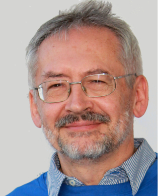
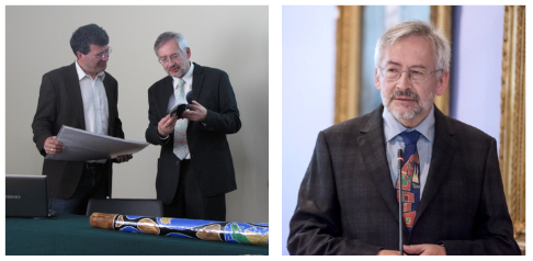
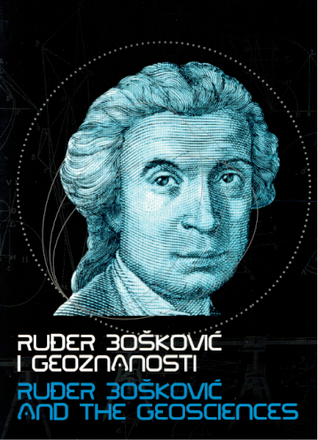
Professor Emeritus Miljenko Lapaine - On the Occasion of his 70th Birthday
Miljenko Lapaine was born in Zagreb on 4 April 1952. After primary school and junior music school, he attended a mathematics gymnasium and music high school. He then studied mathematics and graduated in 1976 from the Faculty of Natural Sciences and Mathematics of the University of Zagreb, majoring in theoretical mathematics.
He enrolled in postgraduate studies in geodesy, specializing in cartography, at the Faculty of Geodesy of the University of Zagreb. He completed it in 1991 by defending his master's thesis under the title
Contemporary approach to map projections. He received his doctorate at the same faculty in 1996 with a dissertation entitled
Mappings in the theory of map projections.
At the Faculty of Geodesy of the University of Zagreb, he was elected assistant in 1978, assistant professor in 1997, associate professor in 2000, full professor in 2003, and full professor with tenure in 2009. The Senate of the University of Zagreb appointed him to the honorary title of Professor Emeritus in 2018.
He was a visiting professor at the Faculty of Architecture, the Department of Geography and the Department of Geology of the Faculty of Natural Sciences and Mathematics at the University of Zagreb, the Department of Geography at the University of Zadar, and at the Faculty of Civil Engineering, Architecture and Geodesy at the University of Split. In 2002, he was elected associate professor, and in 2005, full professor at the Faculty of Civil Engineering at the University of Sarajevo.
He is the author of the internal scripts
Vector analysis - a collection of solved problems,
Approximation theory and Geodesy. Together with D. Jovičić, in 1991 he published a collection of mathematics tests from classification exams, and in 1995 a new collection of mathematics tests. In 2000, he independently published a collection of solved mathematics tests from class exams.
In his work with students, he particularly advocated their introduction to scientific research work, so in addition to helping and leading seminar and diploma theses, he successfully led about twenty students who received the Rector's and Dean's awards. He was the supervisor of eight master's theses and seven defended doctoral theses.
In his scientific work, he mainly deals with the application of mathematics and computer science in geodesy and cartography, as well as with history and the popularization of science, especially cartography. In cooperation with surveyors, he worked on solving various tasks in practical and engineering geodesy, adjustment computation, mechanics, hydrography, photogrammetry and cartography. His
Kartomatika computer system for removing distortions from drawings, plans or maps and the accepted proposal for new official map projections in Croatia particularly stands out.
He was the manager and leader of the projects
State border of the Republic of Croatia at sea,
Drawing in science,
Proposal of official map projections of the Republic of Croatia,
Cartography and new technologies,
Cartography of the Adriatic,
The oldest Croatian geodetic textbook,
Cartography and art,
Cartography and geoinformation, etc.
He participated in about a hundred scientific and professional gatherings, of which we highlight those abroad: Udine 1985, Graz 1985, Nowy Sącz 1987, Vienna 1988, Budapest 1989, Milan 1990, Zurich 1990, Seggauberg 1991, Vienna 1991, Bournemouth 1991, Tehran 1992, Paris 1992, Cologne 1993, Stuttgart 1993, Brno 1994, Tokyo 1994, Barcelona 1995, Vienna 1995, Berlin 1995, Ljubljana 1997, Stockholm 1997, Berlin 1997, Austin 1998, Athens 1999, Ottawa 1999, Beijing 2001, Madrid 2001, Warsaw 2001, Sofia 2002, 2003, Boston, MA, Portland, ME 2003, Durban, 2003, Sofia 2004, A Coruña 2005, Budapest 2005, Bruxelles 2005, Munich 2006, Prague 2007, Moscow 2007, Borovec 2008, Enschede 2008, Dresden 2008, Auckland 2008, Prague 2009, Vienna 2009, Santiago, Chile 2009, Oslo 2009, Vienna 2010, Sydney 2010, Nessebar 2010, Kyoto 2010, Sofia 2011, Paris 2011, Vienna 2011, Nitra 2011, Brno 2011, Albena 2012, Vienna 2012, Budapest 2012, Sint Niklaas 2012, Helsinki 2013, Dresden 2013, Riviera Resort 2014, Innsbruck 2014, Budapest 2014, Pittsburgh, PA, 2014, Corfu 2015, Rio de Janeiro 2015, Vienna 2015, Laško 2016, Albena 2016, Brno 2017, Sozopol 2018, Tokyo 2019, Florence 2021 and Vienna 2022.
He has published more than 1,000 papers in proceedings of scientific and professional conferences and journals. Data on most of his publications are available in the Croatian Scientific Bibliography (https://www.bib.irb.hr/pregled/profil/20299). We can highlight these three works in particular:
Lapaine, M.: A New Direct Solution of the Transformation Problem of Cartesian into Ellipsoidal Coordinates. Presented at the First International Geoid Commission Symposium, Milano, 11-13 June 1990.3s Published in: Rapp, R. and Sansò, F. (Eds.): Determination of the Geoid, Present and Future. Springer Verlag, Proceedings from the International Association of Geodesy Symposia, 1991, Vol. 106, 395-404, doi: 10.1007/978-1-4612-3104-2_46
Lapaine, M.: Prijedlog službenih kartografskih projekcija Republike Hrvatske, Državna geodetska uprava, Sveučilište u Zagrebu (Official Republic of Croatia Map Projections Proposal), Faculty of Geodesy, Zagreb, 2000.
Lapaine, M.: Conformal Mapping of a Rotational Ellipsoid to a Sphere. On the occasion of the proclamation of C.F. Gauss as the global surveyor in 2021. ZfV - Zeitschrift für Geodäsie, Geoinformation und Landmanagement, 2022, Heft 3, 154-162, doi 10.12902/zfv-0387-2022
He is the editor of the monographs
Crtež u znanosti (Drawing in Science) published by the Faculty of Geodesy, Zagreb, 1998,
Elementi kvalitete prostornih podataka (Elements of Quality of Spatial Data) published by the State Geodetic Administration, 2001 and
Exercitationes Gaeodeticae - Geodetske vježbe (Geodetic Exercises) published by the Croatian Geodetic Society, Zagreb, 2002. He is the editor of the Croatian edition of
Atlas za 21. stoljeće (Atlas for the 21st century) Naklada Fran, Zagreb, 2003. Together with D. Novak and D. Mlinarić, he is the editor of the monograph
Five Centuries of Maps and Charts of Croatia - Pet stoljeća geografskih i pomorskih karata Hrvatske published by Školska knjiga, Zagreb, 2005. He is the editor of the catalogue
Pomorska kartografija (Maritime Cartography) accompanying the exhibition of the same name held in the exhibition space of the State Archives in Zadar (2007) and the catalogue
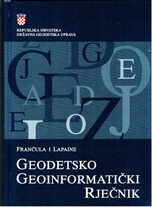
Kartografija Varaždina (Varaždin Cartography) accompanying the exhibition of the same name in the City Museum in Varaždin (2009). Together with N. Frančula, he edited
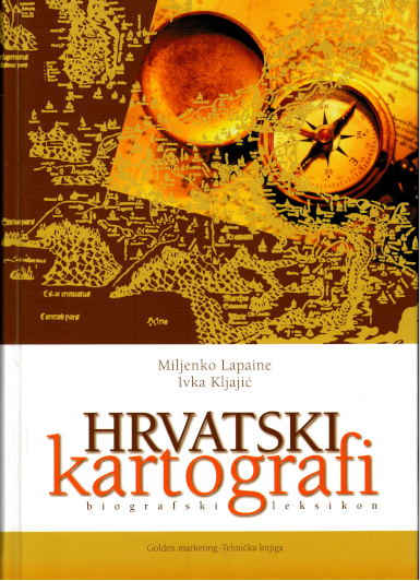
Geodetsko-geoinformatički rječnik (Geodetic-geoinformatic dictionary) published by the State Geodetic Administration, Zagreb, 2008. Together with I. Kljajić, he edited the biographical lexicon
Hrvatski kartografi (Croatian cartographers) published by Golden marketing - Tehnička knjiga, Zagreb, 2009. Together with D. Marjanović, he edited the monograph
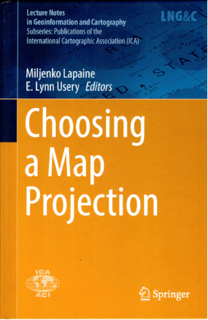
Elementa Geometriae Practicae - Zemlyomirje - Praktična geometrija / zemljomjerstvo (Practical geometry / surveying) published by the Faculty of Geodesy, University of Zagreb and Croatian Geodetic Society, Zagreb, 2010. Together with E. L. Usery, he edited the book
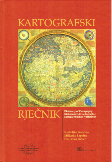
Choosing a Map Projection, Lecture Notes in Geoinformation and Cartography, Springer, 2017. Together with N. Frančula and I. P. Jazbec, he published
Kartografski rječnik (Cartographic Dictionary) published by the Croatian Cartographic Society and Naklada Dominović, Zagreb, 2020. He edited the chronicle of the 15th Symposium of Chartered Geodetic Engineers published by the Croatian Chamber of Chartered Geodetic Engineers, Zagreb, 2022.
He was vice-dean for teaching and students of the Faculty of Geodesy in 2003/05 and 2007/09, head of the Institute for Cartography of the Faculty of Geodesy in 1999/2000, head of the Chair of Geoinformation from 2005 to 2017. He has been an associate of the Miroslav Krleža Institute of Lexicography since 1999. (
Hrvatska enciklopedija,
Tehnički leksikon,
Hrvatski biografski leksikon,
Hrvatska tehnička enciklopedija - Croatian Encyclopaedia, Technical Lexicon, Croatian Biographical Lexicon, Croatian Technical Encyclopaedia). He is a regular member of the Croatian Academy of Engineering, was its secretary general in 2003/05 and vice-president in 2009/13, an emeritus member from 2022.
He is the founder and first president of the Croatian Cartographic Society (2001-2005 and 2012-). He was the organizer or co-organizer of a large number of map exhibitions, book promotions, workshops, professional tours, and held and organized numerous lectures. He organized consultations that grew into annual international conferences on geoinformation and cartography. He is the editor-in-chief of the journal
Kartografija i geoinformacije (Cartography and Geoinformation) (2002-12 and 2021-). The journal is published in Croatian and English in analogue and digital format twice a year.
He is one of the founders of the Association for Geospatial Information in South-East Europe (AGISEE) in 2004/12, and a member of several other international and domestic societies.
Since 1989, he has actively participated in all conferences of the International Cartographic Association (ICA). Since 1995, he has represented Croatia at all general assemblies of the ICA. From 1995 to 2007, he was a corresponding member of the ICA Commission on Standards for the Transfer of Spatial Data. From 2011 to 2019, he was the chairman of the ICA Commission on Map Projections. Since 2019, he has been the vice-chairman of that Commission. Since 2020, he has been a member of the ICA Working Group on the Cartographic Body of Knowledge.
He has received a number of awards and recognitions, of which we highlight the following:
Plaque for active participation in the work of the scientific conference Computing and design using computers, Stubičke toplice, 16-18 November 1983.
Acknowledgement for active participation in the First International Conference on Surveying and Mapping, Tehran 1992.
Medal for participation and contribution to the 8th International Conference on Engineering Computer Graphics and Descriptive Geometry, Austin, Texas, 1998.
For the book
Crtež u znanosti (Drawing in Science) edited by M. Lapaine, the Faculty of Geodesy of the University of Zagreb received the J. J. Strossmayer award for the most successful publishing venture in 1998.
Certificate of appreciation for the successful lecture entitled "Croatian cartographers" which complemented the professional and scientific knowledge of the members of the Croatian Geographical Society - Zadar, 22 May 2001.
Certificate of appreciation for a successful lecture titled "Geodetic and cartographic topics in geography textbooks" which complemented the professional and scientific knowledge of Croatian Geographical Society members - Zadar in the field of cartography and geography teaching methodology, 20 May 2003.
Recognition for special merits during his mandate as Secretary General of the Croatian Academy of Engineering in the period 2003-2005, 28 February 2006.
Recognition for the successful management of the Croatian Academy of Engineering website, and thus its promotion in the country and abroad, 14 March 2008.
Certificate of appreciation for the lecture titled "Over Malaysia to New Zealand", which complemented the professional and scientific knowledge of the members of the Croatian Geographical Society - Zadar, 28 January 2009.
Certificate of appreciation of Prof. Miljenko Lapaine Ph.D. for scientific contribution to the realization of the TK25 project for valuable achievement in science in the field of cartography, State Geodetic Administration, Zagreb, 8 December 2010.
Certificate of appreciation of Prof. Miljenko Lapaine Ph.D. for the lecture titled "HTRS96/TM - the official map projection for Croatia" which complemented the professional and scientific knowledge of the members of the Croatian Geographical Society - Zadar, 2 March 2011.
"Federik Grisogono" award of the Croatian Geographical Society - Zadar in recognition of overall scientific research and pedagogical work, with which Prof. Miljenko Lapaine Ph.D. made a significant contribution to the development of science in Croatia, Zadar, 2 March 2011.
The Matrix Croatica Oton Kučera Award for science for the years 2009 and 2010 for the book
Hrvatski kartografi, biografski leksikon (Croatian cartographers, a biographical lexicon) published by Golden marketing - Tehnička knjiga and the State Geodetic Administration (Miljenko Lapaine together with Ivka Kljajić), Zagreb, 28 June 2011.
Certificate of appreciation for special contribution to the development and reputation of the Croatian Cartographic Society, Zagreb, 10 October 2011.
Recognition of the INNOLEC Lectureship in Cartography and Geoinformation for his valuable contribution to the development of the curriculum at the Faculty of Natural Sciences and Mathematics of the Masaryk University, Czech Republic, Brno, 12 December 2011.
Certificate of appreciation of the Croatian Academy of Engineering for many years of effort and dedication in the work of the Academy Management Board and Presidency, and especially for editing the Academy publications, Zagreb, 20 December 2012.
Certificate of appreciation to Prof. Miljenko Lapaine, "Cartographic-Geoinformatics Dictionary” project leader and manager, for participation in the "Five Years of
Struna", Institute of Croatian Language and Linguistics, 5 December 2013.
Certificate of appreciation to Miljenko Lapaine for participating in the Science Festival, 7-12 April 2014 in the Technical Museum in Zagreb.
Recognition of Prof. Miljenko Lapaine for many years of dedicated work at the Faculty of Geodesy and merit in the development of scientific research work, Faculty of Geodesy, University of Zagreb, 26 September 2014.
Certificate of appreciation to Miljenko Lapaine for participating in the Science Festival, 20-25 April 2015 in the Technical Museum in Zagreb.
Owl statue, sign of gratitude of the Bulgarian Cartographic Society, Riviera, Bulgaria, 15 June 2014.
Certificate of appreciation of the International Cartographic Society to Miljenko Lapaine as chairman of the ICA Commission on Map Projections during the 2011-2015 mandate. The certificate of appreciation was presented at the 16th ICA General Assembly in Rio de Janeiro, Brazil, August 2015.
Certificate of appreciation to Miljenko Lapaine for participating in the Science Festival, 18-23 April 2016 in the Nikola Tesla Technical Museum in Zagreb.
Medal for special contribution to the work of the Croatian Academy of Engineering, 11 May 2016, Zagreb.
Certificate of appreciation to Miljenko Lapaine for participating in the Science Festival, 24-29 April 2017 in the Nikola Tesla Technical Museum in Zagreb.
Certificate of appreciation to Prof. Miljenko Lapaine for many years of dedicated work at the Faculty of Geodesy, University of Zagreb, 29 September 2017.
Memorial medal of the University of Zagreb on the occasion of his retirement, 3 November 2017.
Certificate of appreciation to Miljenko Lapaine for participating in the Science Festival, 16-21 April 2018 in the Nikola Tesla Technical Museum in Zagreb.
Certificate of appreciation to Miljenko Lapaine for participating in the Science Festival, 8-13 April 2019 in the Nikola Tesla Technical Museum in Zagreb.
Recognition of the International Cartographic Society - medal and charter: ICA Honorary Fellowship, 20 July 2019 at the 29th International Cartographic Conference and 18th ICA General Assembly in Tokyo. Prof. Emer. Miljenko Lapaine was elected as an honorary member of the ICA in recognition of his numerous outstanding contributions to the International Cartographic Association and for his exceptional promotion of cartography at the international level.
